
Open-Fronted Store Circa 30 Metres North West Of Manor Farm
Open-Fronted Store Circa 30 Metres North West Of Manor Farm, agricultural structure in North Cerney, Cotswold, Gloucestershire, UK
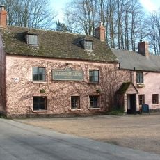
Bathurst Arms
42 m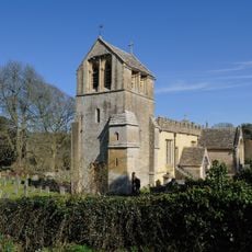
Church of All Saints
200 m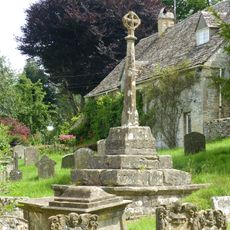
Cross and cross shaft base in the churchyard of the Church of All Saints, circa 9 metres south of the south porch
213 m
Group of 35 17th to 18th century monuments in the churchyard of the Church of All Saints, west of the path to Church Cottage as far as the Henry Baldwin Monument
221 m
Pair of monuments in the churchyard of the Church Of All Saints, circa 18 metres south of the south porch
223 m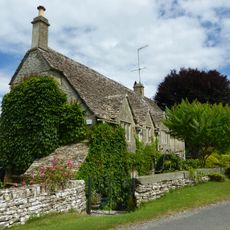
Church Cottage
211 m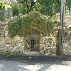
Water pump and water pump recess opposite Elmlea
165 m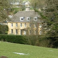
The Old Rectory
273 m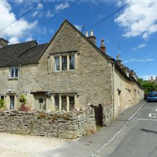
Elmlea
174 m
Stockwell Monument in the churchyard of the Church of All Saints, circa 6 metres west of the porch
216 m
Row of 3 monuments in the churchyard of the Church of All Saints circa 6 and 1/2 metres south east of the chancel
196 m
Mill And Miller's House
78 m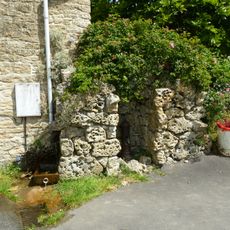
Pump and pump recess circa 10 metres south east of Granny Mabbett's Corner
277 m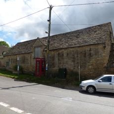
Stableblock circa 50 metres north of Manor Farm
58 m
Thatched Outbuilding Circa 8 Metres North Of Manor Farm
51 m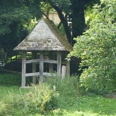
Lychgate on the northern boundary of the churchyard of the Church of All Saints
159 m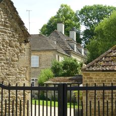
Manor Farm
51 m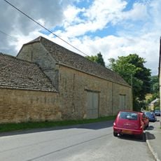
Double barn circa 50 metres north of Manor Farm
24 m
36
110 m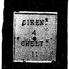
Milestone, N of N Cerney
371 m
23
187 m
Stableblock Circa 30 Metres North East Of The Old Rectory
225 m
Pair Of Cottages At Broadbridge (One Occupied By Mr And Mrs Crump)
264 m
School And School House
104 m
K6 telephone kiosk
56 m
Icehouse Circa 50 Metres South Of Cerney House Beside Path To Stables
526 m
Group of monuments in the churchyard of the Church of All Saints east of the path to Church Cottage as far as the Thomas Radway Monument
210 m
Cerney House
489 mBeoordelingen
Heeft u deze plek bezocht? Tik op de sterren om een beoordeling te geven en uw ervaring of foto's te delen met de community! Probeer het nu! U kunt het op elk moment annuleren.
Ontdek verborgen schatten op elk avontuur!
Van karakteristieke kleine cafeetjes tot geheime uitzichtpunten – ontvlucht de drukte en vind plekken die echt bij jou passen. Onze app maakt het makkelijk: spraakzoekopdrachten, slimme filters, geoptimaliseerde routes en authentieke tips van reizigers wereldwijd. Download nu en beleef het avontuur op je smartphone!

Een nieuwe benadering van toeristische ontdekking❞
— Le Figaro
Alle plekken die de moeite waard zijn om te ontdekken❞
— France Info
Een uitstapje op maat in slechts een paar klikken❞
— 20 Minutes