
Pico de Loro, Berggipfel auf den Philippinen
Locatie: Ilocos Norte
Hoogte boven de zeespiegel: 437 m
GPS-coördinaten: 18.51389,120.88694
Laatste update: 7 juni 2025 om 14:40

Patapat Viaduct
6.9 km
Cape Bojeador Lighthouse
30.5 km
Laoag Cathedral
47.2 km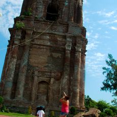
Bacarra Church
41.3 km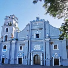
San Nicolas de Tolentino Parish Church
48.8 km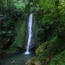
Kabigan Falls
8.9 km
Kalbario-Patapat Natural Park
3.5 km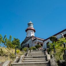
Cape Bojeador Lighthouse
30.5 km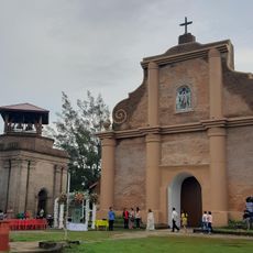
Piddig Church
42.7 km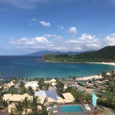
Hannah's Beach Resort
12.8 km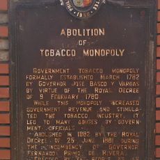
Abolition of Tobacco Monopoly historical marker
47.2 km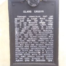
Claro Caluya historical marker
42.7 km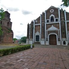
Sarrat Church
47.3 km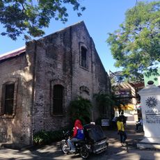
Museo Ilocos Norte
47.1 km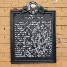
Roque B. Ablan historical marker
47 km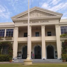
Ilocos Norte Provincial Capitol
47 km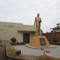
Governor Roque B. Ablan, Sr. Shrine
47 km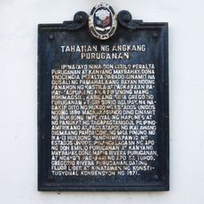
Home of Puruganan Family historical marker
49.8 km
Don Claro Caluya Green Garden
42.7 km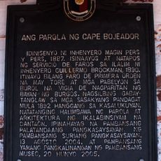
The Lighthouse of Cape Bojeador historical marker
30.5 km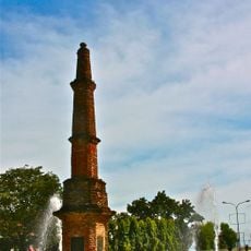
Abolition of Tobacco Monopoly Monument
47.2 km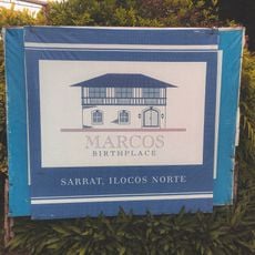
Marcos Museum
47.1 km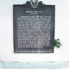
Anastacia Giron Tupas historical marker
47.3 km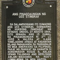
The Landing Site of the USS Stingray historical marker
15.6 km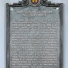
Capitol of the Province of Ilocos Norte historical marker
47.1 km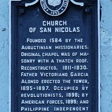
Church of San Nicolas historical marker
48.8 km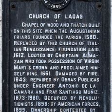
Church of Laoag historical marker
47.2 km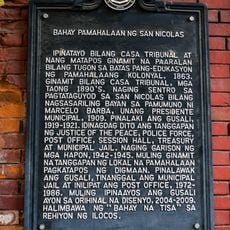
Municipal Hall of San Nicolas historical marker
49 kmBeoordelingen
Heeft u deze plek bezocht? Tik op de sterren om een beoordeling te geven en uw ervaring of foto's te delen met de community! Probeer het nu! U kunt het op elk moment annuleren.
Ontdek verborgen schatten op elk avontuur!
Van karakteristieke kleine cafeetjes tot geheime uitzichtpunten – ontvlucht de drukte en vind plekken die echt bij jou passen. Onze app maakt het makkelijk: spraakzoekopdrachten, slimme filters, geoptimaliseerde routes en authentieke tips van reizigers wereldwijd. Download nu en beleef het avontuur op je smartphone!

Een nieuwe benadering van toeristische ontdekking❞
— Le Figaro
Alle plekken die de moeite waard zijn om te ontdekken❞
— France Info
Een uitstapje op maat in slechts een paar klikken❞
— 20 Minutes