
Manuel S. Enverga historical marker
Manuel S. Enverga historical marker, NHI historical marker for Manuel Enverga in Mauban
Locatie: Mauban
Ontstaan: 2009
Maker: National Historical Commission of the Philippines
GPS-coördinaten: 14.18808,121.73264
Laatste update: 8 maart 2025 om 00:16

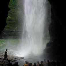
Pagsanjan Falls
26.4 km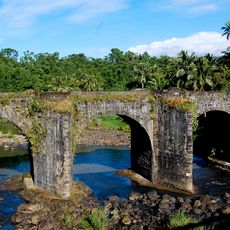
Malagonlong Bridge
23.2 km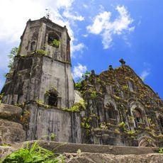
Lucban Church
20.9 km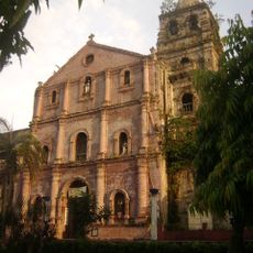
Majayjay Church
28.6 km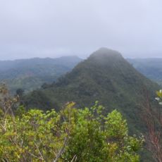
Quezon Protected Landscape
17.3 km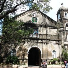
Cainta Church
79.4 km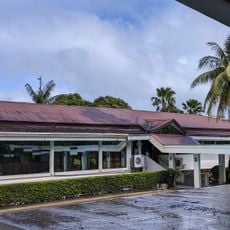
Nawawalang Paraiso
23.4 km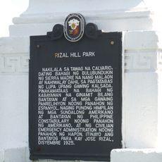
Rizal Hill Park historical marker
217 m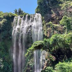
Hulugan Falls
27.4 km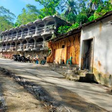
Dalitiwan Resort
26.4 km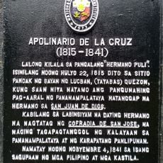
Apolinario de la Cruz historical marker
20.8 km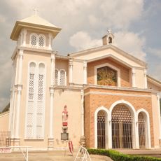
Mauban Church
326 m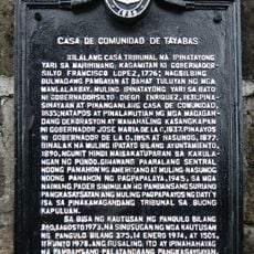
Casa de Comunidad de Tayabas historical marker
23.6 km
Lucban Municipal Hall
20.9 km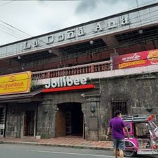
La Doña Ana
20.8 km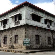
Casa Comunidad of Tayabas
23.6 km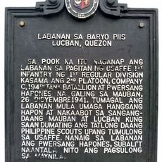
Battle of Barrio Piis historical marker
15.4 km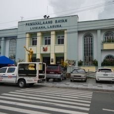
Luisiana Municipal Hall
24.1 km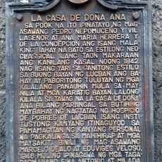
La Casa de Doña Ana historical marker
20.8 km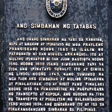
The Church of Tayabas historical marker
23.7 km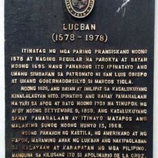
Lucban historical marker
20.9 km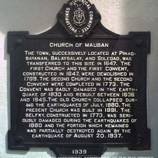
Church of Mauban historical marker
320 m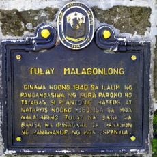
Malagonlong Bridge historical marker
23.1 km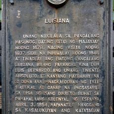
Luisiana historical marker
24.1 km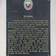
Tayabas historical marker
23.6 km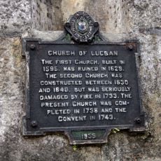
Church of Lucban historical marker
20.9 km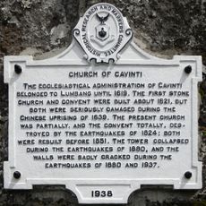
Church of Cavinti historical marker
25.1 km
Horacio de la Costa, S.J. historical marker
242 mBeoordelingen
Heeft u deze plek bezocht? Tik op de sterren om een beoordeling te geven en uw ervaring of foto's te delen met de community! Probeer het nu! U kunt het op elk moment annuleren.
Ontdek verborgen schatten op elk avontuur!
Van karakteristieke kleine cafeetjes tot geheime uitzichtpunten – ontvlucht de drukte en vind plekken die echt bij jou passen. Onze app maakt het makkelijk: spraakzoekopdrachten, slimme filters, geoptimaliseerde routes en authentieke tips van reizigers wereldwijd. Download nu en beleef het avontuur op je smartphone!

Een nieuwe benadering van toeristische ontdekking❞
— Le Figaro
Alle plekken die de moeite waard zijn om te ontdekken❞
— France Info
Een uitstapje op maat in slechts een paar klikken❞
— 20 Minutes