Santa Maria, gemeente in de Filipijnse provincie Laguna
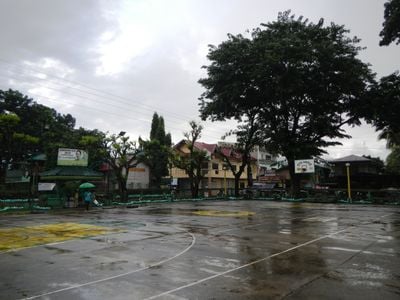
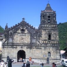
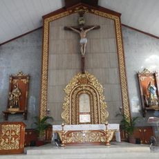
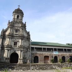
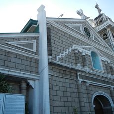
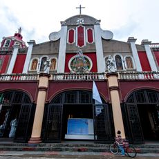
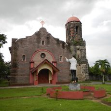
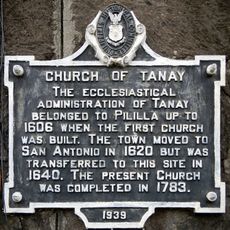
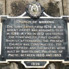
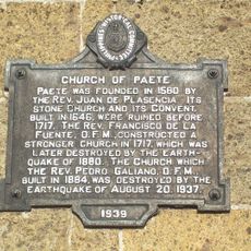
Santa Maria is een kleine gemeente in de provincie Laguna op de Filipijnen, bestaande uit 25 administratieve gebieden genaamd barangays. De parochiekerk Nuestra Señora de los Angeles staat in het centrum en is meerdere keren herbouwd, waarbij de gevel nog kenmerken van vroege Spaanse bouwkunst vertoont.
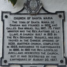
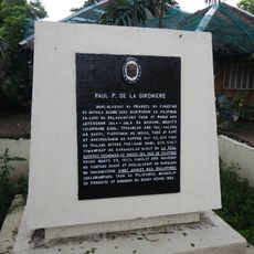
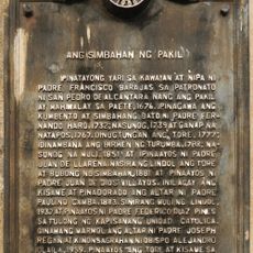
De stad was oorspronkelijk onderdeel van een groter gebied genaamd Caboan, wat bamboebosje betekent, en heette San Miguel de Caboan tijdens de Spaanse periode. Na meerdere natuurrampen en conflicten werd de kerk herhaaldelijk verwoest en herbouwd, vooral na de Tweede Wereldoorlog.
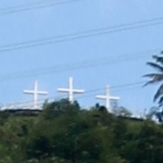
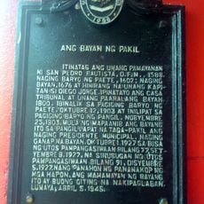
De naam van de stad komt uit een legende over een afbeelding van de Maagd Maria die een koppel vond na terugkeer van de markt, wat zij als wonderbaarlijk beschouwden. Mensen verzamelen zich voor lokale festivals en religieuze vieringen waar traditionele dansen, liederen en ambachten het gedeelde erfgoed levend houden.
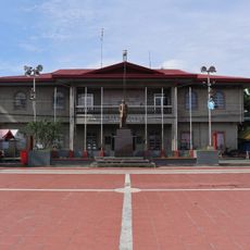
De stad ligt ongeveer 50 kilometer van het centrum van de hoofdstad Manila en is toegankelijk voor een dagtrip. Belangrijkste locaties zijn op loopafstand, aangezien de straten breed en gemakkelijk te navigeren zijn.
De naam van de stad komt van een paar dat vond wat zij dachten dat een porseleinen figuur was, maar bleek een heilig beeld van de Maagd Maria te zijn, waarvan werd geloofd dat het wonderen kon verrichten. Deze ontdekking leidde tot de bouw van de eerste kerk en maakte de plek spiritueel belangrijk voor veel mensen.
De community van nieuwsgierige reizigers
AroundUs brengt duizenden geselecteerde plaatsen, lokale tips en verborgen pareltjes samen, dagelijks verrijkt door meer dan 60,000 bijdragers wereldwijd.