
Conner, gemeente in de Filipijnse provincie Apayao
Locatie: Apayao
Hoogte boven de zeespiegel: 174 m
Grenst aan: Tineg, Balbalan, Pinukpuk
GPS-coördinaten: 17.80861,121.28889
Laatste update: 29 maart 2025 om 19:07

Callao Cave
57.9 km
Basilica of Our Lady of Piat
20.4 km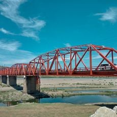
Buntunbrug
47.9 km
Tuguegarao Cathedral
51.6 km
Mount Ambalatungan
58.3 km
Magapit Suspension Bridge
53.6 km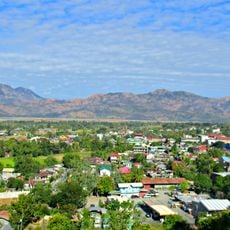
Cassamata Hill National Park
74.9 km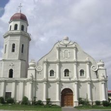
Saint Catherine of Alexandria Parish Church
70.6 km
Balbalasang-Balbalan National Park
44.7 km
Lal-lo Church
58.7 km
Malaueg Church
7.2 km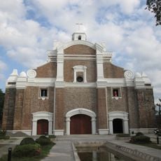
Dingras Church
70.5 km
Magapit Protected Landscape
59.1 km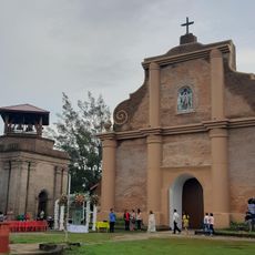
Piddig Church
72.5 km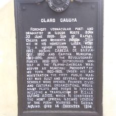
Claro Caluya historical marker
72.6 km
Phare de Linao Point
70.3 km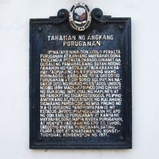
Home of Puruganan Family historical marker
70.7 km
Don Claro Caluya Green Garden
72.6 km
Chapel of San Jacinto historical marker
51 km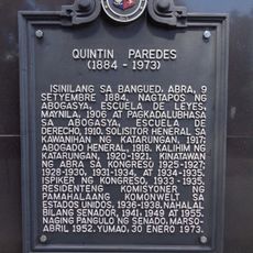
Quintin Paredes historical marker
74.8 km
Tabuk Cathedral
47.2 km
St. Paul University Philippines historical marker
50.9 km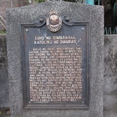
Ruins of the Catholic Church of Dingras historical marker
70.6 km
The Cathedral of Tuguegarao historical marker
51.6 km
Lalloc–Tocolana historical marker
58.7 km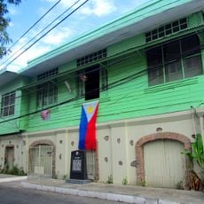
Quintin Paredes Ancestral House
74.8 km
Lalloc–Nueva Segovia historical marker
58.7 km
Church of Iguig historical marker
47.7 kmBeoordelingen
Heeft u deze plek bezocht? Tik op de sterren om een beoordeling te geven en uw ervaring of foto's te delen met de community! Probeer het nu! U kunt het op elk moment annuleren.
Ontdek verborgen schatten op elk avontuur!
Van karakteristieke kleine cafeetjes tot geheime uitzichtpunten – ontvlucht de drukte en vind plekken die echt bij jou passen. Onze app maakt het makkelijk: spraakzoekopdrachten, slimme filters, geoptimaliseerde routes en authentieke tips van reizigers wereldwijd. Download nu en beleef het avontuur op je smartphone!

Een nieuwe benadering van toeristische ontdekking❞
— Le Figaro
Alle plekken die de moeite waard zijn om te ontdekken❞
— France Info
Een uitstapje op maat in slechts een paar klikken❞
— 20 Minutes