Locatie inschakelen

We hebben je locatie nodig om interessante plaatsen in je buurt te tonen

Ontdek plaatsen in de buurt

Vind interessante locaties en verborgen pareltjes om je heen

Precieze routebeschrijving

Krijg nauwkeurige routebeschrijvingen en afstanden naar plaatsen

Je locatie wordt nooit gedeeld met andere gebruikers. Het wordt alleen gebruikt wanneer je op de locatieknop tikt.

Geodetische boog van Struve

Inloggen op je account

Bewaar je favoriete plekken
Maak aangepaste reisroutes
Beoordeel en recenseer plaatsen
Toegang tot de volledige interactieve kaart
Doorgaan met Google
Doorgaan met Apple
Doorgaan met e-mail
Door door te gaan, accepteer je onze Algemene voorwaarden en ons Privacybeleid
Maak een account aan
Toevoegen aan collectie
Kaart
Wijziging voorstellen
Delen

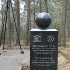
Geodetische boog van Struve, Triangulatienetwerk in Noord-Europa.

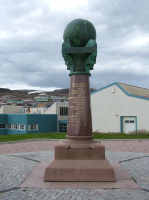
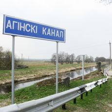
De Struve-geodetische boog is een keten van opmeetpunten die zich uitstrekt van Hammerfest in Noorwegen tot aan de Zwarte Zee, met een totaal bereik van 2.821 kilometer. De 265 meetpunten zijn gemarkeerd met geodetische monumenten die precieze coördinaatgegevens bevatten en verdeeld over verschillende huidige landen.

Tussen 1816 en 1855 stelde de astronoom Friedrich Georg Wilhelm von Struve deze metketen op om de exacte grootte en vorm van de Aarde te bepalen. Het project ontstond toen nauwkeurige meting van het aardoppervlak cruciaal was geworden voor navigatie en cartografie.

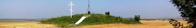
Het netwerk ontstond uit wetenschappelijke samenwerking tussen meerdere Europese landen in de 19e eeuw, een keerpunt in internationale samenwerking aan grootschalige opmeting. De bewaarde meetpunten vertellen van een tijd toen opmeting handwerk was en landen deze taak samen ondernamen.

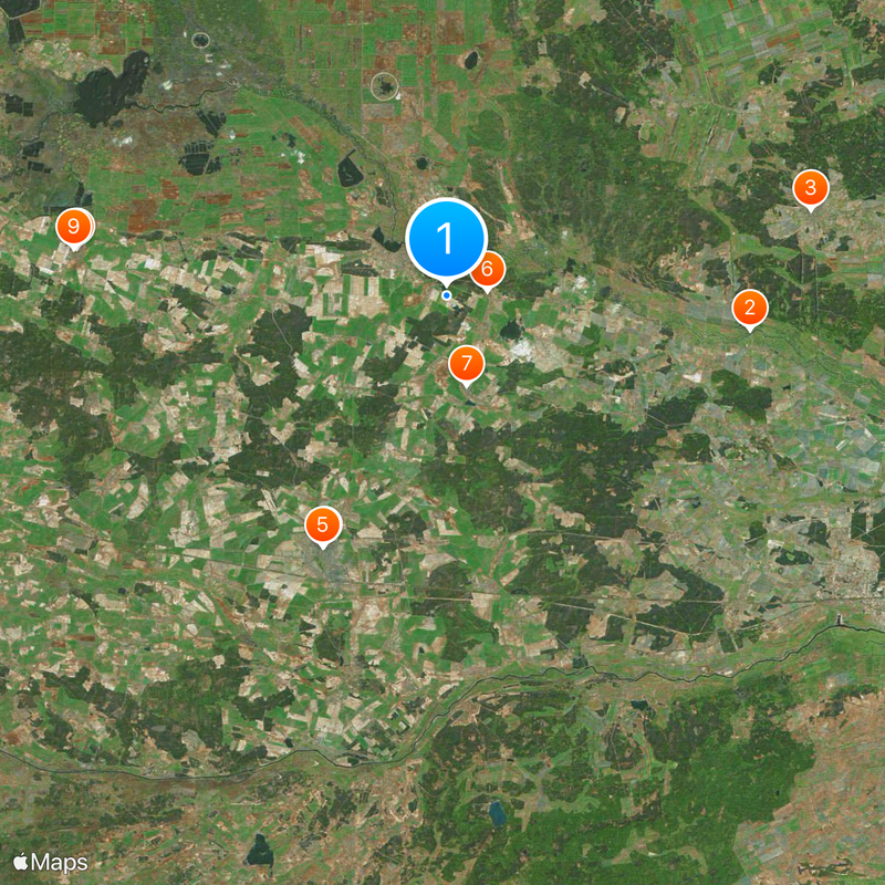
De meetpunten zijn verspreid over verschillende landen en kunnen onafhankelijk worden verkend, sommige liggen in afgelegen gebieden. Plan voor verschillende toegangsomstandigheden afhankelijk van de regio en informeer ter plaatse naar de exacte locatie van elk monument.

De metingen onthulden dat de Aarde aan de polen afgeplatst is, wat fundamentaal veranderde hoe wetenschappers de vorm van de planeet begrepen. Deze bevinding was revolutionair voor de wetenschap van die tijd en bevestigde theoretische voorspellingen.

Locatie: Jyväskylä

Locatie: Tornio

Locatie: Lapinjärvi

Locatie: Enontekiö

Locatie: Ylitornio

Locatie: Pyhtää

Onderdeel van: World Heritage Site

GPS-coördinaten: 52.28944,25.64944

Laatste update: 14 december 2025 om 21:41

Foto's
Rond deze plek
Oginski Canal
Wit-Rusland

Oginski Canal

19.3 km
Saints Peter and Paul churches in Lahišyn
Wit-Rusland

Saints Peter and Paul churches in Lahišyn

23.6 km
Church of the Exaltation of the Cross in Ivanava
Wit-Rusland

Church of the Exaltation of the Cross in Ivanava

17.6 km
Orthodox church of the Pokrov in Ivanava
Wit-Rusland

Orthodox church of the Pokrov in Ivanava

17.6 km
Skirmunt Manor in Moladava
Wit-Rusland

Skirmunt Manor in Moladava

2.6 km
Holy Trinity Orthodox church in Dastojeva
Wit-Rusland

Holy Trinity Orthodox church in Dastojeva

5.8 km
Holy Trinity Orthodox church in Biezdziež
Wit-Rusland

Holy Trinity Orthodox church in Biezdziež

23.5 km
Касцёл Найсвяцейшай Тройцы, Бездзеж
Wit-Rusland

Касцёл Найсвяцейшай Тройцы, Бездзеж

23.6 km
Orthodox church of the Transfiguration of Jesus Christ in Motal
Wit-Rusland

Orthodox church of the Transfiguration of Jesus Christ in Motal

4.1 km
Chapel-burial-vault of Skirmunt family, Moladava
Wit-Rusland

Chapel-burial-vault of Skirmunt family, Moladava

2.8 km
Помнік Напалеону Орду
Wit-Rusland

Помнік Напалеону Орду

17.8 km
Saint Paraskeva of Serbia church in Ladavičy
Wit-Rusland

Saint Paraskeva of Serbia church in Ladavičy

17.2 km
Church of the Nativity of Our Lady in Vavuličy
Wit-Rusland

Church of the Nativity of Our Lady in Vavuličy

21.3 km
Church of the Nativity of Our Lady in Parečča
Wit-Rusland

Church of the Nativity of Our Lady in Parečča

12.1 km
Exaltation of the Holy Cross church in Brodnica, Ivanava District
Wit-Rusland

Exaltation of the Holy Cross church in Brodnica, Ivanava District

18.2 km
Church of the Nativity of Our Lady in Liaskavičy
Wit-Rusland

Church of the Nativity of Our Lady in Liaskavičy

15.3 km
Church of the Exaltation of the Cross in Achova
Wit-Rusland

Church of the Exaltation of the Cross in Achova

21.4 km
Сядзіба, Дастоева
Wit-Rusland

Сядзіба, Дастоева

7.5 km
Church of the Ascension of Christ in Liachavičy, Ivanava District
Wit-Rusland

Church of the Ascension of Christ in Liachavičy, Ivanava District

12.7 km
Спаса-Узнясенская царква, Моладава
Wit-Rusland

Спаса-Узнясенская царква, Моладава

2.9 km
Church of the Dormition of Our Lady in Snitava
Wit-Rusland

Church of the Dormition of Our Lady in Snitava

22.7 km
Saint Nicholas church in Družylavičy
Wit-Rusland

Saint Nicholas church in Družylavičy

8.6 km
Holy Trinity church in Łahišyn
Wit-Rusland

Holy Trinity church in Łahišyn

23.6 km
Orthodox church of the Nativity of Our Lady in Dubaje
Wit-Rusland

Orthodox church of the Nativity of Our Lady in Dubaje

23.2 km
Church of Protection of the Holy Virgin in Biarozavičy
Wit-Rusland

Church of Protection of the Holy Virgin in Biarozavičy

20.9 km
Category:Saint Athanasius of Brest church in Jaječkavičy
Wit-Rusland

Category:Saint Athanasius of Brest church in Jaječkavičy

23.6 km
Saint Alexander Nevsky church in Streĺna
Wit-Rusland

Saint Alexander Nevsky church in Streĺna

19.7 km
Čekuck geodetic point
Wit-Rusland

Čekuck geodetic point

10.5 km
Toon de volledige kaart
Beoordelingen

Heeft u deze plek bezocht? Tik op de sterren om een beoordeling te geven en uw ervaring of foto's te delen met de community! Probeer het nu! U kunt het op elk moment annuleren.

« Geodetische boog van Struve - Triangulatienetwerk in Noord-Europa » wordt geleverd door Around Us (nl.aroundus.com). Afbeeldingen en teksten zijn afkomstig van het Wikimedia-project onder een Creative Commons-licentie. U mag kopieën van deze pagina kopiëren, verspreiden en wijzigen onder de voorwaarden van de licentie, zolang deze opmerking duidelijk zichtbaar is.

Ontdek verborgen schatten op elk avontuur!

Van karakteristieke kleine cafeetjes tot geheime uitzichtpunten – ontvlucht de drukte en vind plekken die echt bij jou passen. Onze app maakt het makkelijk: spraakzoekopdrachten, slimme filters, geoptimaliseerde routes en authentieke tips van reizigers wereldwijd. Download nu en beleef het avontuur op je smartphone!

Around Us App Screenshot

Een nieuwe benadering van toeristische ontdekking

Le Figaro

Alle plekken die de moeite waard zijn om te ontdekken

France Info

Een uitstapje op maat in slechts een paar klikken

20 Minutes