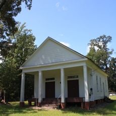
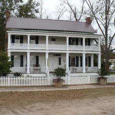
Dry Fork Plantation, human settlement in Alabama, United States of America
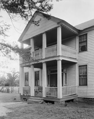
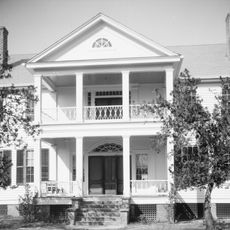
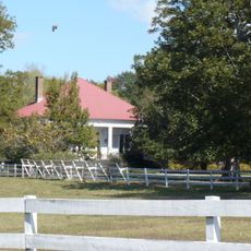
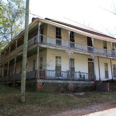
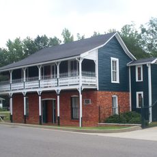
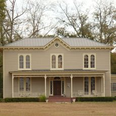
Dry Fork Plantation is een twee verdiepingen tellende boerderij gebouwd in het midden van de jaren 1830 met houten bekleding en een puntdak. Het huis heeft acht kamers van ongeveer 5,5 meter breed met hoge plafonds, een centrale gang met kamers aan beide zijden, en werd gebouwd met meer dan 25.000 hout stukken en ongeveer 12.000 bakstenen die op het terrein werden gemaakt.
Het huis werd gebouwd tussen 1832 en 1834 voor James Asbury Tait, een welgestelde planter uit Maryland die grote landgoederen en honderden geënslaveerde mensen beheerde. Het werd in 1999 ingeschreven op het Nationaal Register van Historische Plaatsen en blijft het oudste gedocumenteerde huis in Wilcox County, Alabama.
De naam verwijst naar een plaatselijke beek die belangrijk was voor de eerste nederzettingen in de regio. Het huis weerspiegelt waarden van familiestabiliteit en gevestigde welvaart die de plattelandssamenleving in de 19e eeuw bepaalden.
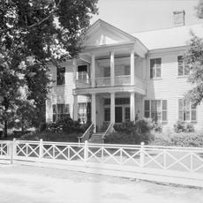
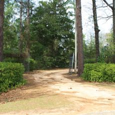
Het huis ligt op rustig terrein ongeveer 400 meter ten oosten van een hoofdweg bij Sedan en is zichtbaar vanaf de straat, maar is nog steeds een privé-woning. Bezoekers moeten het van de weg bekijken en de privacy van de huidige bewoners respecteren, omdat er geen parkeerplaats beschikbaar is en de voetgang beperkt is.
Het huis werd gebouwd door geënslaveerde ambachtslieden genaamd Hezekiah en Elijah die de decoratieve houtwerk in het interieur met de hand vervaardigden, inclusief gesneden schoorsteenmantels, deuren en cornices met patronen zoals waaiervormen en chevrons. Dit vakmanschap wordt nu erkend als een belangrijk onderdeel van de architecturale prestatie van het huis.
De community van nieuwsgierige reizigers
AroundUs brengt duizenden geselecteerde plaatsen, lokale tips en verborgen pareltjes samen, dagelijks verrijkt door meer dan 60,000 bijdragers wereldwijd.