Probable site of old hut
Locatie: Jeogla
Locatie: Armidale Regional Council
GPS-coördinaten: -30.78836,152.14823
Laatste update: 21 november 2025 om 13:58
Oxley Wild Rivers National Park
17.8 km
Carrai National Park
14 km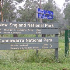
Cunnawarra National Park
27.9 km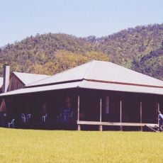
Kunderang East Pastoral Station
12.9 km
Uitzichtpunt
21.2 km
Chandler River Lookout
24.3 km
Old cattle yards
25.8 km
Uitzichtpunt
12.3 km
Uitzichtpunt
16.4 km
Uitzichtpunt
10.8 km
Uitzichtpunt
12.4 km
Budds Mare Lookout
27.5 km
Uitzichtpunt
21.9 km
Uitzichtpunt
4.3 km
Aboriginal bark-stripped tree
23.9 km
Aboriginal Coolamon tree
24.2 km
Eely Creek Fire Lookout
24.7 km
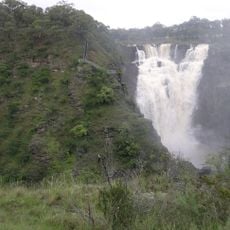
Falls Lookout
13.6 km
Raspberry Fire Lookout
12.2 km
Marys View
6.8 km
Uitzichtpunt
6.5 km
Remains of hearth
9.3 km
Cattle yards (1890's)
24.3 km
Old water well
19 km
Possible site of old hut
19 km
Old cattle yards (corner post)
17 km
Old cattle yards (corner post)
16.8 km
Oaky Falls
24.8 kmBeoordelingen
Heeft u deze plek bezocht? Tik op de sterren om een beoordeling te geven en uw ervaring of foto's te delen met de community! Probeer het nu! U kunt het op elk moment annuleren.
Ontdek verborgen schatten op elk avontuur!
Van karakteristieke kleine cafeetjes tot geheime uitzichtpunten – ontvlucht de drukte en vind plekken die echt bij jou passen. Onze app maakt het makkelijk: spraakzoekopdrachten, slimme filters, geoptimaliseerde routes en authentieke tips van reizigers wereldwijd. Download nu en beleef het avontuur op je smartphone!

Een nieuwe benadering van toeristische ontdekking❞
— Le Figaro
Alle plekken die de moeite waard zijn om te ontdekken❞
— France Info
Een uitstapje op maat in slechts een paar klikken❞
— 20 Minutes