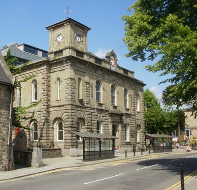
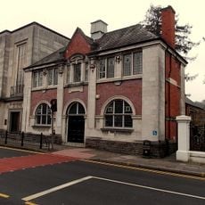
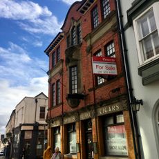
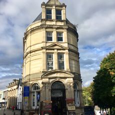
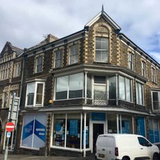
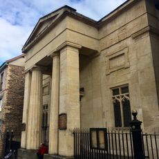
Town Hall, Grade II listed building in Torfaen County Borough. In the centre of Pontypool at the junction of Hanbury Road and Glentorvaen Road
Het stadhuis is een stenen gebouw met Italiaanse stijl gebouwd in het midden van de jaren 1800 en geopend in 1856. De gevel heeft vijf ongelijke secties met de linkerkant licht uitstekend en een kleine klokkentoren, terwijl de rechterkant terugzet, en de centrale ingang wordt omlijst door hoge zuilen en een boog.
Het gebouw werd in 1854 gesticht als geschenk van Lord Lieutenant Capel Hanbury Leigh ter gelegenheid van de geboorte van zijn zoon en in 1856 geopend met een formeel concert. In de 20e eeuw werd het de belangrijkste zetel van de lokale regering en werd het later uitgebreid.
Het stadhuis diende als verzamelplaats waar bewoners bijeenkwamen voor burgerlijke vergaderingen en lokale vieringen. Het blijft onderdeel van het gemeenschapsleven in Pontymoile.
Het gebouw is bereikbaar via Hanbury Road en heeft een beschermde status die zijn historische kenmerken bewaart. Bezoekers moeten weten dat het als actief regeringscentrum functioneert, dus de toegang kan beperkt zijn.
De eerste steen werd in 1854 gelegd door Mrs. Hanbury Leigh, en de openingsfeest was een elegant avondconcert in plaats van een traditionele ceremonie. Dit was belangrijk omdat Pontymoile nog nooit een toegewijd openbaar ontmoetingsplein had gehad.
De community van nieuwsgierige reizigers
AroundUs brengt duizenden geselecteerde plaatsen, lokale tips en verborgen pareltjes samen, dagelijks verrijkt door meer dan 60,000 bijdragers wereldwijd.