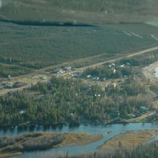
Thinahtea South Protected Area, protected area in British Columbia, Canada
Locatie: Northern Rockies Regional Municipality
GPS-coördinaten: 59.65389,-120.31889
Laatste update: 23 november 2025 om 02:30
Trout Lake, Northwest Territories
101.8 km
Andy Bailey Provincial Park
175 km
Redknife Formation
182.7 km
Maxhamish Lake Provincial Park and Protected Area
167 km
Jackpine Remnant Protected Area
176.2 km
Hay-Zama Lakes Wildland Provincial Park
122.8 km
Sikanni Old Growth Provincial Park
176.7 km
Kotcho Lake Village Provincial Park
82.6 km
60th Parallel Territorial Park
190.6 km
Whittaker Falls
168.4 km
Kotcho Lake Ecological Reserve
78.6 km
Fort Nelson River Ecological Reserve
146.6 km
Parker Lake Ecological Reserve
174.8 km
Maxhamish Lake Protected Area
169.7 km
Goguka Creek Protected Area
186.6 km
Hay River Protected Area
107.6 km
Ekwan Lake Protected Area
128.1 km
Thinahtea North Protected Area
15.6 km
Sambaa Deh Falls Territorial Park
167.8 km
Table Rock Rapids
177.2 km
Coral Falls
167.1 km
NWT Sign
190.6 km
Mozzy the Mosquito
138.5 km
Uitzichtpunt
125.4 km
Uitzichtpunt
167.2 km
Uitzichtpunt
168.2 km
Uitzichtpunt
187.1 km
Waterval
170.4 kmBeoordelingen
Heeft u deze plek bezocht? Tik op de sterren om een beoordeling te geven en uw ervaring of foto's te delen met de community! Probeer het nu! U kunt het op elk moment annuleren.
Ontdek verborgen schatten op elk avontuur!
Van karakteristieke kleine cafeetjes tot geheime uitzichtpunten – ontvlucht de drukte en vind plekken die echt bij jou passen. Onze app maakt het makkelijk: spraakzoekopdrachten, slimme filters, geoptimaliseerde routes en authentieke tips van reizigers wereldwijd. Download nu en beleef het avontuur op je smartphone!

Een nieuwe benadering van toeristische ontdekking❞
— Le Figaro
Alle plekken die de moeite waard zijn om te ontdekken❞
— France Info
Een uitstapje op maat in slechts een paar klikken❞
— 20 Minutes