
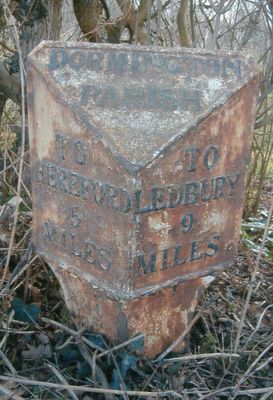
Milepost At National Grid Reference So577403, milestone in Dormington, County of Herefordshire, UK
Locatie: Dormington
Ontstaan: 19e eeuw
GPS-coördinaten: 52.05937,-2.61829
Laatste update: 5 maart 2025 om 22:36

Stoke Edith House
2.8 km
Longworth Roman Catholic Chapel
905 m
The New Inn
1.9 km
The Moon Inn
3 km
Church of St Mary
2.7 km
Church of the Holy Rood
2.9 km
Church of St Andrew
2.9 km
Church of St Peter
620 m
Church of St Peter
2.7 km
Church of St John Baptist
1.2 km
The Old Post Office
3 km
The White Stone And Fragment Of Base Immediately To The East
2.8 km
Convent Of Our Lady Of Charity
910 m
Sufton Court
2.4 km
Mordiford Bridge
2.9 km
Longworth Hall
1.5 km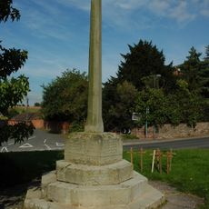
Lugwardine War Memorial
2.7 km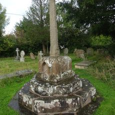
Churchyard cross in St Andrew's churchyard
2.9 km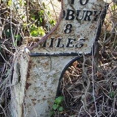
Milepost At So593246
1.6 km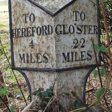
Milepost At S0568375
3 km
Churchyard Cross
2.7 km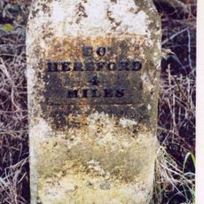
Mile Stone About 250 Yards East-North-East Of The White Stone
3 km
Churchyard cross in Holy Rood churchyard
2.9 km
The Steps Farmhouse
2.5 km
Guidestone, Mordiford Bridge
2.9 km
Milestone, Whitestone House, White Stone Cross
2.7 km
Milestone, Castle Farm at SO59224275
2.9 km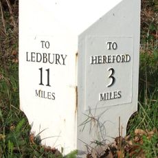
Milepost, opp church, jct with Lumber Lane
2.7 kmBeoordelingen
Heeft u deze plek bezocht? Tik op de sterren om een beoordeling te geven en uw ervaring of foto's te delen met de community! Probeer het nu! U kunt het op elk moment annuleren.
Ontdek verborgen schatten op elk avontuur!
Van karakteristieke kleine cafeetjes tot geheime uitzichtpunten – ontvlucht de drukte en vind plekken die echt bij jou passen. Onze app maakt het makkelijk: spraakzoekopdrachten, slimme filters, geoptimaliseerde routes en authentieke tips van reizigers wereldwijd. Download nu en beleef het avontuur op je smartphone!

Een nieuwe benadering van toeristische ontdekking❞
— Le Figaro
Alle plekken die de moeite waard zijn om te ontdekken❞
— France Info
Een uitstapje op maat in slechts een paar klikken❞
— 20 Minutes