
Prehistoric carved rocks and associated remains including cairns and a field system 800m south of Haythwaite, Barningham Moor
Prehistoric carved rocks and associated remains including cairns and a field system 800m south of Haythwaite, Barningham Moor, petroglyph in Barningham, County Durham, England, UK
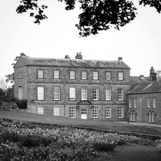
Barningham Park
3.4 km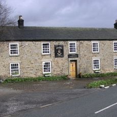
Milbank Arms
3.4 km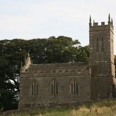
Church of St Mary
4.2 km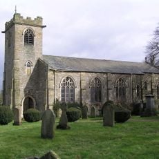
Church of St. Michael
3.4 km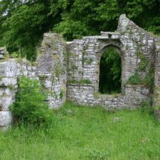
Ruins of Old Church of St Mary
4.3 km
Monument On Adam Hill, South East Of Barningham Park
3.5 km
Carved rock and Romano-British settlement known as Greystone, 250m south of Moorcock Farm, Barningham Moor
1.5 km
Cairn on the summit of Arndale Hill, Hope Moor
3.8 km
Cairn near the summit of a low ridge, 850m south west of Cocker Stake Nook, Hope Moor
2.8 km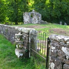
Churchyard Wall Around Old Church Of St Mary
4.3 km
Cairn south of Cross Gill, 645m south east of Black Hill Gate, Barningham Moor
1.2 km
Cairn, 650m SSE of Bragg House, Barningham Moor
1.7 km
A carved rock and boulder walling, near the south wall of Scale Knoll Allotment, 500m north east of Black Hill Gate
967 m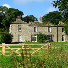
Brignall Grange
4.2 km
Carved rocks, cairnfield and rubble banks on the terrace south of Scale Knoll Allotment, immediately east of Black Hill Gate, Ba
939 m
Carved rock 380m ENE of Bragg House, Barningham Moor
2.3 km
Cairn, 625m SSE of Bragg House, Barningham Moor
1.7 km
A carved rock between The Stang Forest boundary wall and Woodclose Gill, 750m south east of Far East Hope, Barningham Moor
1.3 km
Carved rock and cairn in Rowley Intake, 410m south east of Cowclose House, Barningham Moor
1.3 km
Cairn, 545m ESE of Bragg House, Barningham Moor
2.3 km
Cairnfield and associated remains, 250m south east of Bragg House, Barningham Moor
2.2 km
A carved rock within a large enclosure, 800m north east of Badger Way Stoop, Barningham Moor
1.1 km
Cairnfield on a small knoll at Badger Way Stoop, Barningham Moor
791 m
Carved rock north of Washbeck Green, 570m south of Haythwaite, Barningham Moor
236 m
Prehistoric settlement and associated remains including carved rocks and a stone circle 400m north west of How Tallon Cairn, Bar
754 m
Carved rock and prehistoric enclosure on west side of Scale Knoll Gill, 410m south west of Haythwaite, Barningham Moor
576 m
Cairnfield partly enclosed by a bank, on the east side of Woodclose Gill, Scale Knoll Allotment, Barningham Moor, 550m south of
1.2 km
Cairn on Holgate How
3.7 kmBeoordelingen
Heeft u deze plek bezocht? Tik op de sterren om een beoordeling te geven en uw ervaring of foto's te delen met de community! Probeer het nu! U kunt het op elk moment annuleren.
Ontdek verborgen schatten op elk avontuur!
Van karakteristieke kleine cafeetjes tot geheime uitzichtpunten – ontvlucht de drukte en vind plekken die echt bij jou passen. Onze app maakt het makkelijk: spraakzoekopdrachten, slimme filters, geoptimaliseerde routes en authentieke tips van reizigers wereldwijd. Download nu en beleef het avontuur op je smartphone!

Een nieuwe benadering van toeristische ontdekking❞
— Le Figaro
Alle plekken die de moeite waard zijn om te ontdekken❞
— France Info
Een uitstapje op maat in slechts een paar klikken❞
— 20 Minutes