RAF Sealand, Militaire luchtmachtbasis in Flintshire, Wales.
RAF Sealand is een militaire luchtmachtbasis in Flintshire, Wales, met hangars, administratieve gebouwen en gespecialiseerde trainingsfaciliteiten verspreid over het terrein. De basis omvat onderhoudswerkplaatsen, schone kamers en gespecialiseerde testchambers voor geavanceerde luchtvaartsystemen.
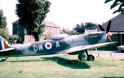
Het station werd in 1916 opgericht als RFCS Shotwick en diende als trainingsveld tijdens de Eerste Wereldoorlog. Het sloot zich in 1924 aan bij de Royal Air Force en werd later een belangrijk onderhoud- en reparatiefaciliteit voor vliegtuigen.
De militaire installatie inspireerde lokale muzikanten toen de band Orchestral Manoeuvres in the Dark in 1981 een nummer getiteld Sealand uitbracht. Deze verbinding laat zien hoe de plaats deel is geworden van de regionale muziekcultuur.
De faciliteit ligt in het noordoosten van Wales dicht bij de Engelse grens en is bereikbaar met openbaar vervoer of auto. Bezoekers moeten weten dat het een actieve militaire basis is waar de toegang beperkt kan zijn tot geautoriseerd personeel.
De basis dient als wereldwijd onderhoudscentrum voor F-35 Lightning II gevechtsvliegtuigen, met geavanceerde schone kamers en radartestfaciliteiten. Deze specialisatie maakt het een centrum voor moderne vliegtuigtechnologie in het Verenigd Koninkrijk.
De community van nieuwsgierige reizigers
AroundUs brengt duizenden geselecteerde plaatsen, lokale tips en verborgen pareltjes samen, dagelijks verrijkt door meer dan 60,000 bijdragers wereldwijd.