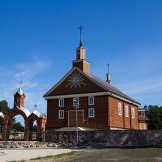
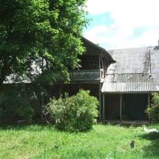
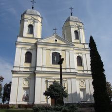
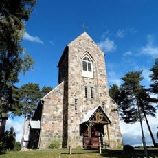
Kulionys, dorp in Litouwen
Locatie: Molėtai District Municipality
GPS-coördinaten: 55.31667,25.56667
Laatste update: 25 maart 2025 om 03:48
Labanoras Regional Park
12.6 km
Molėtai Astronomisch Observatorium
225 m
Lithuanian Museum of Ethnocosmology
749 m
Skudutiškis
10.1 km
Church of the Nativity of the Virgin Mary, Labanoras
14.3 km
Čiulai manor
10.1 km
Church of St. Peter and St. Paul, Molėtai
12.9 km
Church of the Martyrdom of St. John the Baptist, Stirniai
10.8 km
Valiulio akmuo
11.2 km
Church of the Holy Trinity, Skudutiškis
10.2 km
Church of St. John the Baptist, Kuktiškės
11 km
Church of the Discovery of the Holy Cross in Suginčiai
3.5 km
Kulionys hillfort
994 m
Pakalniai Geomorphological Reserve
14 km
Utenis stone
14.1 km
Mindučių akmuo
8.7 km
Rudesa chapel
12.6 km
Pakalnių ąžuolas
13.8 km
Church of the Holy Trinity, Pakalniai
14.5 km
Želvos hillfort
1.2 km
Dryžiai hillfort
15 km
Vorėnai hillfort
5.3 km
Svobiškėlis Hillfort
11.9 km
Karališkių piliakalnis
10.7 km
Čiulėnai hillfort
4.2 km
Kampų piliakalnis
11.5 km
Levaniškių akmuo
9.3 km
Kulioniai Landscape Reserve
2.6 kmBeoordelingen
Heeft u deze plek bezocht? Tik op de sterren om een beoordeling te geven en uw ervaring of foto's te delen met de community! Probeer het nu! U kunt het op elk moment annuleren.
Ontdek verborgen schatten op elk avontuur!
Van karakteristieke kleine cafeetjes tot geheime uitzichtpunten – ontvlucht de drukte en vind plekken die echt bij jou passen. Onze app maakt het makkelijk: spraakzoekopdrachten, slimme filters, geoptimaliseerde routes en authentieke tips van reizigers wereldwijd. Download nu en beleef het avontuur op je smartphone!
Een nieuwe benadering van toeristische ontdekking❞
— Le Figaro
Alle plekken die de moeite waard zijn om te ontdekken❞
— France Info
Een uitstapje op maat in slechts een paar klikken❞
— 20 Minutes