
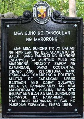
Ruins of Fort Marorong historical marker
Ruins of Fort Marorong historical marker, NHCP historical marker for Fort Marorong
Locatie: Sarangani
Ontstaan: 22 juni 2022
Maker: National Historical Commission of the Philippines
GPS-coördinaten: 5.41544,125.42931
Laatste update: 9 maart 2025 om 06:03
Mount Apo
175.8 km
Mount Matutum
112.2 km
Kathedraal van Davao
184.7 km
Monfort Bat Sanctuary
196.8 km
Awu
193.1 km
Davao River Bridge
189 km
Mati Protected Landscape
191.6 km
Mount Apo Natural Park
175.1 km
D' Bone Collector Museum
184.3 km
Mount Hamiguitan Range Wildlife Sanctuary
169.4 km
Museo Dabawenyo
183.4 km
Pacman Beach Resort Complex
66.7 km
Burial Site of the Seventeen Filipino Martyrs of Koronadal historical marker
137 km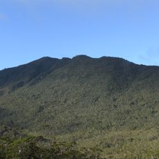
Mount Hamiguitan
169.4 km
Mount Parker
98.1 km
Davao City Hall historical marker
184.6 km
Gen. Paulino Santos historical marker
82.6 km
Andres Bonifacio historical marker
178.6 km
Davao Museum of History and Ethnography
189.7 km
Ohta Kyozaburo historical marker
187 km
Baywalk
191.8 km
Museyo Kutawato
190.2 km
KCC Cinema
136.7 km
Koronadal Cathedral
136.9 km
Wasag Beach
170.2 km
Port Sta. Ana historical marker
186 km
Pujada Bay Protected Seascape
183.7 km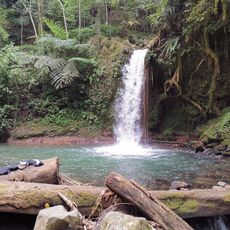
Balnunto Falls
136.5 kmHeeft u deze plek bezocht? Tik op de sterren om een beoordeling te geven en uw ervaring of foto's te delen met de community! Probeer het nu! U kunt het op elk moment annuleren.
Ontdek verborgen schatten op elk avontuur!
Van karakteristieke kleine cafeetjes tot geheime uitzichtpunten – ontvlucht de drukte en vind plekken die echt bij jou passen. Onze app maakt het makkelijk: spraakzoekopdrachten, slimme filters, geoptimaliseerde routes en authentieke tips van reizigers wereldwijd. Download nu en beleef het avontuur op je smartphone!

Een nieuwe benadering van toeristische ontdekking❞
— Le Figaro
Alle plekken die de moeite waard zijn om te ontdekken❞
— France Info
Een uitstapje op maat in slechts een paar klikken❞
— 20 Minutes