
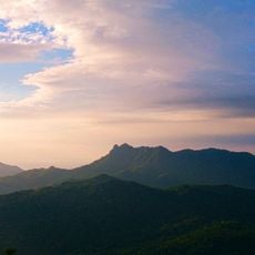
Silyang Bato, cliff located at Mount Mataas na Gulod inside Palay-Palay - Mataas na Gulod Protected Landscape in Luzon, Philippines
Locatie: Nasugbu
Hoogte boven de zeespiegel: 628 m
GPS-coördinaten: 14.19853,120.68581
Laatste update: 7 maart 2025 om 01:33

Mount Pico de Loro
4.9 km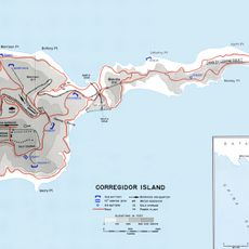
Fort Frank
10.8 km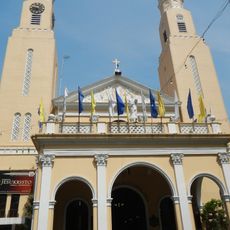
Paco Church
19 km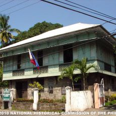
Bonifacio Trial House
10.1 km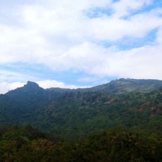
Mount Marami
30 m
St. Gregory the Great Parish Church
16.6 km
Nuestra Señora del Buen Suceso de Parañaque
15.1 km
Casa Hacienda de Naic
16 km
Naic Church
16 km
Kaytitinga Falls
18.5 km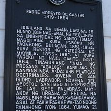
Father Modesto de Castro historical marker
15.9 km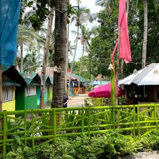
Ternate Beach Resort
10.1 km
Villa Colmenar Natural Spring Resort
18.9 km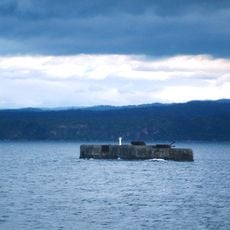
Phare de Fort Drum
13.3 km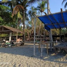
Paniman Beach
9.4 km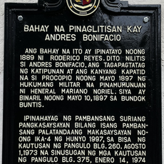
Andres Bonifacio Trial House historical marker
10.1 km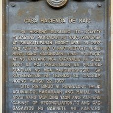
Casa Hacienda de Naic historical marker
16 km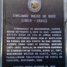
Emiliano Riego de Dios historical marker
9.9 km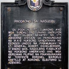
Landing at Nasugbu historical marker
15.6 km
Seaside Beach Resort
15.5 km
Mount Nagpatong historical marker
7.9 km
Bonifacio Shrine and Eco-Tourism Park
8 km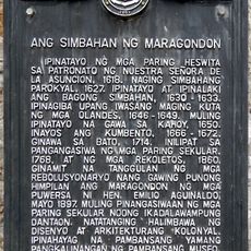
The Church of Maragondon historical marker
9.9 km
Layag Layag Beach
11 km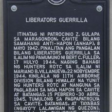
Liberators Guerrilla historical marker
10 km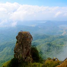
Parrot's Beak
4.6 km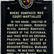
Where Bonifacio was Court-Martialled historical marker
10.1 km
Fuego Beach 2
14.1 kmHeeft u deze plek bezocht? Tik op de sterren om een beoordeling te geven en uw ervaring of foto's te delen met de community! Probeer het nu! U kunt het op elk moment annuleren.
Ontdek verborgen schatten op elk avontuur!
Van karakteristieke kleine cafeetjes tot geheime uitzichtpunten – ontvlucht de drukte en vind plekken die echt bij jou passen. Onze app maakt het makkelijk: spraakzoekopdrachten, slimme filters, geoptimaliseerde routes en authentieke tips van reizigers wereldwijd. Download nu en beleef het avontuur op je smartphone!

Een nieuwe benadering van toeristische ontdekking❞
— Le Figaro
Alle plekken die de moeite waard zijn om te ontdekken❞
— France Info
Een uitstapje op maat in slechts een paar klikken❞
— 20 Minutes