
Panganiban, gemeente in de Filipijnse provincie Catanduanes
Locatie: Catanduanes
Hoogte boven de zeespiegel: 63 m
Grenst aan: Caramoran
Website: http://panganiban-catanduanes.gov.ph
GPS-coördinaten: 13.90000,124.30000
Laatste update: 9 maart 2025 om 18:59
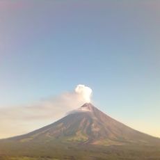
Mayon
97.8 km
Cagsawa Ruins
104.3 km
Mount Isarog
103.8 km
Mount Iriga
103.8 km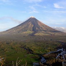
Mayon Volcano Natural Park
97.8 km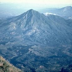
Mount Masaraga
100.2 km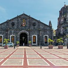
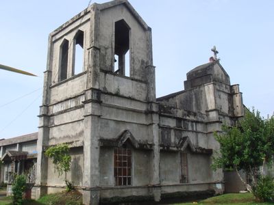
Tabaco Church
86.2 km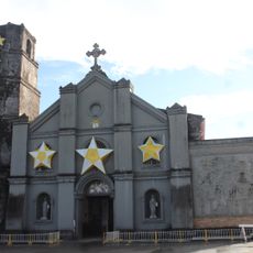
Buhi Church
99.4 km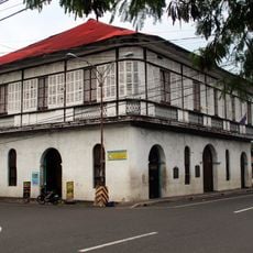
Smith, Bell and Company House
86 km
Mount Isarog Natural Park
102.9 km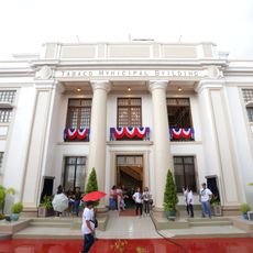
Tabaco City Hall
86.1 km
Bacon Church
100 km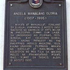
Angela Manalang Gloria historical marker
86 km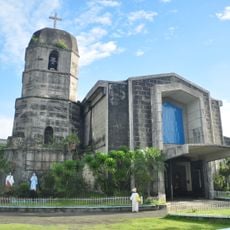
Virac Cathedral
36.4 km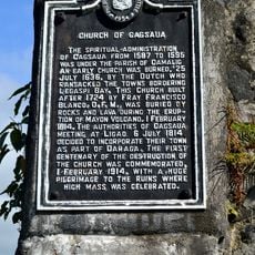
Church of Cagsaua historical marker
104.3 km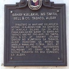
Commercial Building of Smith, Bell & Co. Tabaco, Albay historical marker
86 km
La Edley
103.3 km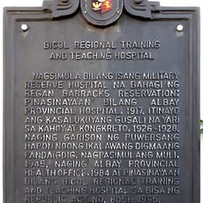
Bicol Regional Training and Teaching Hospital historical marker
104.4 km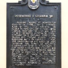
Potenciano V. Gregorio Sr. historical marker
93 km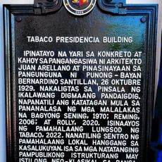
Tabaco Presidencia Building historical marker
86.1 km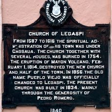
Church of Legaspi historical marker
102.4 km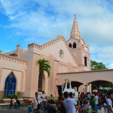
Legazpi Church
102.4 km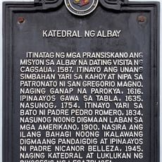
Cathedral of Albay historical marker
104.6 km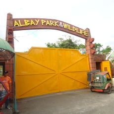
Albay Park and Wildlife
103.2 km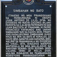
Church of Bato historical marker
32.3 km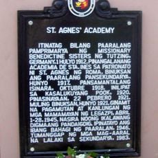
St. Agnes Academy historical marker
104 km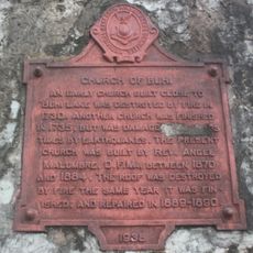
Church of Buhi historical marker
99.3 km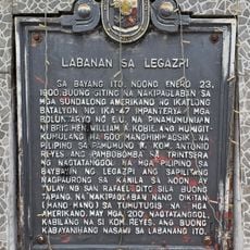
Battle of Legazpi historical marker
102.6 kmHeeft u deze plek bezocht? Tik op de sterren om een beoordeling te geven en uw ervaring of foto's te delen met de community! Probeer het nu! U kunt het op elk moment annuleren.
Ontdek verborgen schatten op elk avontuur!
Van karakteristieke kleine cafeetjes tot geheime uitzichtpunten – ontvlucht de drukte en vind plekken die echt bij jou passen. Onze app maakt het makkelijk: spraakzoekopdrachten, slimme filters, geoptimaliseerde routes en authentieke tips van reizigers wereldwijd. Download nu en beleef het avontuur op je smartphone!

Een nieuwe benadering van toeristische ontdekking❞
— Le Figaro
Alle plekken die de moeite waard zijn om te ontdekken❞
— France Info
Een uitstapje op maat in slechts een paar klikken❞
— 20 Minutes