
Tuy, gemeente in de Filipijnse provincie Batangas
Locatie: Batangas
Ontstaan: 12 augustus 1866
Hoogte boven de zeespiegel: 143 m
Grenst aan: Lian, Balayan
GPS-coördinaten: 14.01667,120.73333
Laatste update: 27 maart 2025 om 22:01


Mount Pico de Loro
24.3 km
Puzzle Mansion
20.5 km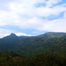
Mount Marami
20.9 km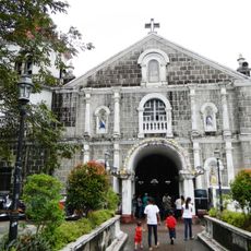
St. Gregory the Great Parish Church
23.7 km
Sky Ranch
23.8 km
Kaytitinga Falls
14.4 km
Agoncillo-Mariño House
25.2 km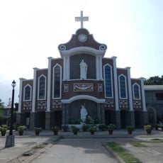
Lemery Church
24.5 km
Villa Colmenar Natural Spring Resort
22 km
Lago de Oro
16.4 km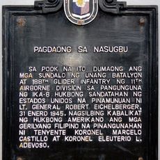
Landing at Nasugbu historical marker
13.2 km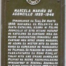
Marcela Mariño de Agoncillo historical marker
25.2 km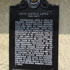
Sixto Castelo Lopez historical marker
8.5 km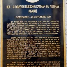
41st Division Philippine Army (USAFFE) historical marker
23.9 km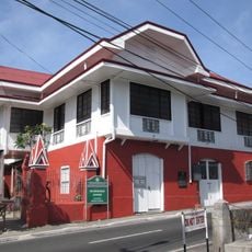
Leon Apacible Museum
25.3 km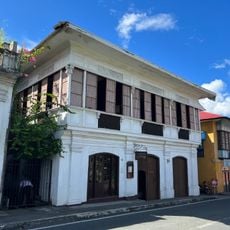
Galleria Taal
25.3 km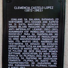
Clemencia Castelo Lopez historical marker
8.5 km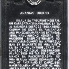
Ananias Diokno historical marker
25.2 km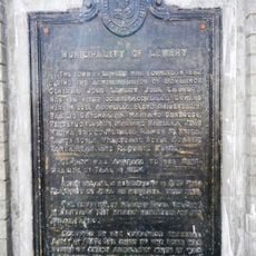
Municipality of Lemery historical marker
24.5 km
Layag Layag Beach
23.7 km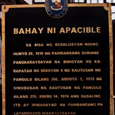
House of Apacible historical marker
25.3 km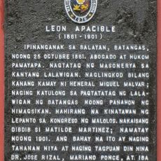
Leon Apacible historical marker
25.3 km
Silyang Bato
20.9 km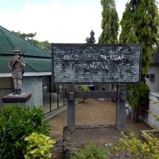
41st Division Philippine Army-USAFFE Shrine
23.9 km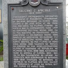
Galicano C. Apacible historical marker
8.8 km
Parrot's Beak
23.9 km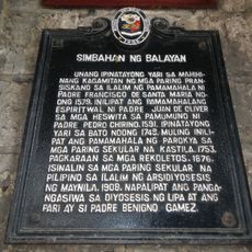
Church of Balayan historical marker
8.8 km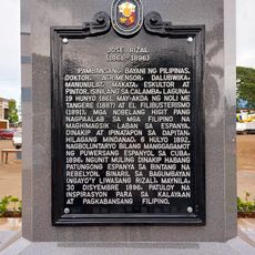
Jose Rizal historical marker
438 mHeeft u deze plek bezocht? Tik op de sterren om een beoordeling te geven en uw ervaring of foto's te delen met de community! Probeer het nu! U kunt het op elk moment annuleren.
Ontdek verborgen schatten op elk avontuur!
Van karakteristieke kleine cafeetjes tot geheime uitzichtpunten – ontvlucht de drukte en vind plekken die echt bij jou passen. Onze app maakt het makkelijk: spraakzoekopdrachten, slimme filters, geoptimaliseerde routes en authentieke tips van reizigers wereldwijd. Download nu en beleef het avontuur op je smartphone!

Een nieuwe benadering van toeristische ontdekking❞
— Le Figaro
Alle plekken die de moeite waard zijn om te ontdekken❞
— France Info
Een uitstapje op maat in slechts een paar klikken❞
— 20 Minutes