Maco, gemeente in de Filipijnse provincie Compostela Valley
Locatie: Davao de Oro
Ontstaan: 17 juni 1967
Hoogte boven de zeespiegel: 114 m
Grenst aan: Mawab
Website: https://maco.gov.ph
GPS-coördinaten: 7.36194,125.85528
Laatste update: 8 maart 2025 om 00:11
Samal
37.2 km
Kathedraal van Davao
42.8 km
Pantaron Mountain Range
69.5 km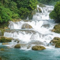
Aliwagwag Protected Landscape
71.5 km
Monfort Bat Sanctuary
28.5 km
Epol Falls
68.9 km
Davao River Bridge
40.6 km
Mati Protected Landscape
55.4 km
Mount Apo Natural Park
74.4 km
Secdea Beach Resort Reception Area
25 km
D' Bone Collector Museum
42.9 km
Museo Dabawenyo
44.7 km
Tagum Cathedral
10.7 km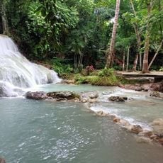
Panas Falls
25.9 km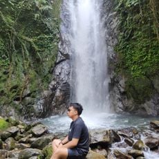
Tagbibinta Falls
35.3 km
Davao City Hall historical marker
42.9 km
Bamboo Garden Resort
36.6 km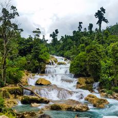
Aliwagwag Falls
64.8 km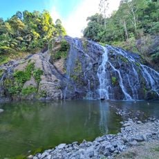
Awao Falls 2 and 3
65.9 km
Tagum Historical & Cultural Center
11.1 km
Andres Bonifacio historical marker
55 km
Davao Museum of History and Ethnography
36.7 km
Ohta Kyozaburo historical marker
49.3 km
Baywalk
60.8 km
Talisay Beach
71.7 km
Port Sta. Ana historical marker
40.8 km
Buhangin Memorial Park
38 km
Pujada Bay Protected Seascape
71.2 kmHeeft u deze plek bezocht? Tik op de sterren om een beoordeling te geven en uw ervaring of foto's te delen met de community! Probeer het nu! U kunt het op elk moment annuleren.
Ontdek verborgen schatten op elk avontuur!
Van karakteristieke kleine cafeetjes tot geheime uitzichtpunten – ontvlucht de drukte en vind plekken die echt bij jou passen. Onze app maakt het makkelijk: spraakzoekopdrachten, slimme filters, geoptimaliseerde routes en authentieke tips van reizigers wereldwijd. Download nu en beleef het avontuur op je smartphone!

Een nieuwe benadering van toeristische ontdekking❞
— Le Figaro
Alle plekken die de moeite waard zijn om te ontdekken❞
— France Info
Een uitstapje op maat in slechts een paar klikken❞
— 20 Minutes