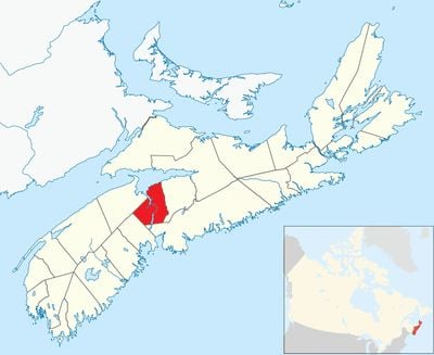
West Hants Regional Municipality, regional municipality in Nova Scotia, Canada
Locatie: Hants County
Grenst aan: Kings County
Website: https://westhants.ca/#
GPS-coördinaten: 44.96670,-64.10000
Laatste update: 8 maart 2025 om 01:19
Minas Basin
32 km
Fort Edward
4.1 km
Grand-Pré National Historic Site
22.9 km
RCAF Station Beaverbank
30.1 km
Blomidon Provincial Park
38.4 km
Raymond Field
25.2 km
Fort Vieux Logis
4.1 km
Churchill House
12.5 km
Prescott House Museum
27.2 km
Uniacke Estate Museum Park
21.4 km
Charles Macdonald Concrete House Museum
37.7 km
Atlantic Food and Horticulture Research Centre
31.9 km
Kings County Museum
33.4 km
Hants Exhibition Arena
3 km
Haliburton House Museum
4.1 km
Covenanter Church
21.9 km
Shand House Museum
4.4 km
Boot Island National Wildlife Area
23.7 km
Coldbrook Provincial Park
38.9 km
Medford Beach
31.5 km
Blomidon Lookoff Provincial Park
35.5 km
Cape Split Provincial Park
46.6 km
Horton Bluff front range light
18.6 km
Ottawa House
48.9 km
Fort Edward Blockhouse
4.3 km
Convocation Hall
3.3 km
Chase House
25.5 km
Grand-Pré Memorial Chapel
23.1 kmBeoordelingen
Heeft u deze plek bezocht? Tik op de sterren om een beoordeling te geven en uw ervaring of foto's te delen met de community! Probeer het nu! U kunt het op elk moment annuleren.
Ontdek verborgen schatten op elk avontuur!
Van karakteristieke kleine cafeetjes tot geheime uitzichtpunten – ontvlucht de drukte en vind plekken die echt bij jou passen. Onze app maakt het makkelijk: spraakzoekopdrachten, slimme filters, geoptimaliseerde routes en authentieke tips van reizigers wereldwijd. Download nu en beleef het avontuur op je smartphone!
Een nieuwe benadering van toeristische ontdekking❞
— Le Figaro
Alle plekken die de moeite waard zijn om te ontdekken❞
— France Info
Een uitstapje op maat in slechts een paar klikken❞
— 20 Minutes