Huabal District, district in Cajamarca, Peru
Locatie: Jaén Province
Hoogte boven de zeespiegel: 1.785 m
Grenst aan: Bellavista District, Las Pirias District, Jaén District, San José del Alto District
GPS-coördinaten: -5.61170,-78.90067
Laatste update: 7 maart 2025 om 20:36
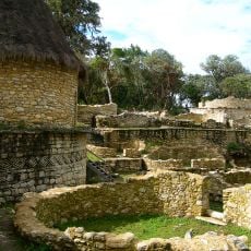
Kuelap
140.6 km
Gocta Cataracts
121.2 km
Nationaal park Cutervo
66.9 km
Pómac Forest Historical Sanctuary
136.4 km
Alto Mayo Protection Forest
133.1 km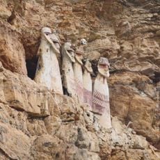
Sarcophagi of Carajía
115 km
Batán Grande
137.7 km
Laquipampa Wildlife Refuge
104.5 km
Pacopampa
81.4 km
Yacurí National Park
116 km
Yumbilla Falls
115.8 km
Teleférico de Kuelap
139.2 km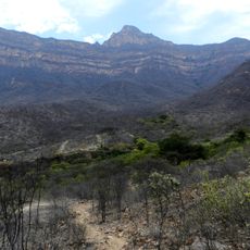
Private Conservation Area Chaparrí
131.1 km
Pongo de Rentema
40 km
Pagaibamba Protection Forest
90.4 km
Cañón del Sonche
131.8 km
Church of Our Lady of the Pillar
140.9 km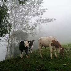
Bosques Nublados de Udima Wildlife Refuge
139 km
Q'arachupa
76.4 km
Señor de Burgos Church, Amazonas
133.5 km
Ñaupe River
110.6 km
El Tintero
140.6 km
Cataratas Numparket
64.2 km
Atumpucro
144.1 km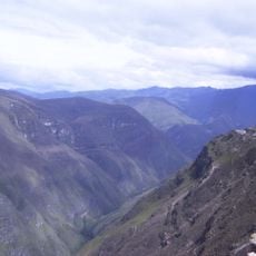
Río Sonche
124.4 km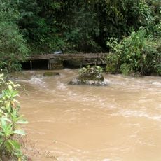
Río Serranoyacu
143 km
Cueva de las Tres Naranjas
61.3 km
Cueva de Atunpampa
119.1 kmBeoordelingen
Heeft u deze plek bezocht? Tik op de sterren om een beoordeling te geven en uw ervaring of foto's te delen met de community! Probeer het nu! U kunt het op elk moment annuleren.
Ontdek verborgen schatten op elk avontuur!
Van karakteristieke kleine cafeetjes tot geheime uitzichtpunten – ontvlucht de drukte en vind plekken die echt bij jou passen. Onze app maakt het makkelijk: spraakzoekopdrachten, slimme filters, geoptimaliseerde routes en authentieke tips van reizigers wereldwijd. Download nu en beleef het avontuur op je smartphone!

Een nieuwe benadering van toeristische ontdekking❞
— Le Figaro
Alle plekken die de moeite waard zijn om te ontdekken❞
— France Info
Een uitstapje op maat in slechts een paar klikken❞
— 20 Minutes