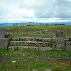
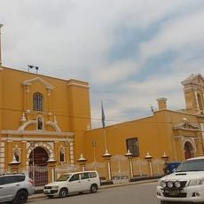
Pucalá District, district in Lambayeque, Peru
Locatie: Chiclayo province
Hoofdstad: Pucalá
Hoogte boven de zeespiegel: 82 m
Grenst aan: Chongoyape District, Oyotún District, Cayalti District, Saña District, Tumán District, Patapo District
GPS-coördinaten: -6.78143,-79.61066
Laatste update: 6 maart 2025 om 18:38
The Royal Tombs of Sipan Museum
33 km
Túcume
39.3 km
Nationaal park Cutervo
111.5 km
Pómac Forest Historical Sanctuary
38.9 km
Kuntur Wasi
93 km
Cumbe Mayo
123.4 km
Sipán
2.4 km
Batán Grande
40.3 km
Ventarron
16.1 km
Laquipampa Wildlife Refuge
50.1 km
St. Mary's Cathedral, Chiclayo
25.1 km
Pacopampa
82.8 km
Brüning Museum
33.5 km
Chotuna-Chornancap
38.4 km
Private Conservation Area Chaparrí
29.3 km
Pacatnamu
59.8 km
Museo de Sitio Huaca Rajada - Sipán
2.3 km
Pagaibamba Protection Forest
72.9 km
Museo de Sitio Túcume
39.5 km
Bosques Nublados de Udima Wildlife Refuge
64.5 km
Zaña Afroperuvian Museum
16 km
Palacio Municipal, Chiclayo
25.2 km
Sicán National Museum
26.1 km
Layzon
125.2 km
La Leche River
51.3 km
Iglesia Matriz de Guadalupe
53.7 km
Museo Kuntur Wasi
93.2 km
Casa Montjoy
33.9 kmHeeft u deze plek bezocht? Tik op de sterren om een beoordeling te geven en uw ervaring of foto's te delen met de community! Probeer het nu! U kunt het op elk moment annuleren.
Ontdek verborgen schatten op elk avontuur!
Van karakteristieke kleine cafeetjes tot geheime uitzichtpunten – ontvlucht de drukte en vind plekken die echt bij jou passen. Onze app maakt het makkelijk: spraakzoekopdrachten, slimme filters, geoptimaliseerde routes en authentieke tips van reizigers wereldwijd. Download nu en beleef het avontuur op je smartphone!
Een nieuwe benadering van toeristische ontdekking❞
— Le Figaro
Alle plekken die de moeite waard zijn om te ontdekken❞
— France Info
Een uitstapje op maat in slechts een paar klikken❞
— 20 Minutes