
Daghveg, commune and town in Mauritania
Locatie: Barkewol or Aftout Department
Locatie: Assaba Region
GPS-coördinaten: 16.48778,-12.49050
Laatste update: 31 maart 2025 om 00:46

Great Mosque of Touba
404.3 km
Niokolo-Koba National Park
392.5 km
Nationaal park Djoudj
401.6 km
Olympische Stadion
412.8 km
Aoukar Depression
359.7 km
River Gambia National Park
413.5 km
MacCarthy Island
409.9 km
Saoedische Moskee
411.4 km
Gouina Falls
313 km
National Museum of Mauritania
410.8 km
National Library of Mauritania
410.9 km
Félou Falls
267.2 km
Talari Gorges
342.7 km
Cercles de pierres de Wassu
402.1 km
Mosque Marocaine
411.1 km
Deer Island (Gambia)
413.4 km
Sapu Island
415.1 km
Tata of Koniakary
272.4 km
Ould Abas-moskee
411.2 km
Bird Island
405.1 km
Eisenbahnbrücke von Kidira
227.8 km
Cercles de pierres de Kerbatch
414.1 km
Sankulay Kunda Bridge
410.6 km
Straßenbrücke von Kidira
228.3 km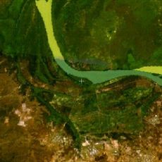
Pangon Island
408.8 km
Pasari Island
354 km
Fort de Médine
264 km
Stade Bassi Coulibaly
254.2 kmBeoordelingen
Heeft u deze plek bezocht? Tik op de sterren om een beoordeling te geven en uw ervaring of foto's te delen met de community! Probeer het nu! U kunt het op elk moment annuleren.
Ontdek verborgen schatten op elk avontuur!
Van karakteristieke kleine cafeetjes tot geheime uitzichtpunten – ontvlucht de drukte en vind plekken die echt bij jou passen. Onze app maakt het makkelijk: spraakzoekopdrachten, slimme filters, geoptimaliseerde routes en authentieke tips van reizigers wereldwijd. Download nu en beleef het avontuur op je smartphone!

Een nieuwe benadering van toeristische ontdekking❞
— Le Figaro
Alle plekken die de moeite waard zijn om te ontdekken❞
— France Info
Een uitstapje op maat in slechts een paar klikken❞
— 20 Minutes