Playa El Tamarindo
Locatie: Municipio de Metapán
GPS-coördinaten: 14.24357,-89.48029
Laatste update: 16 november 2025 om 19:58
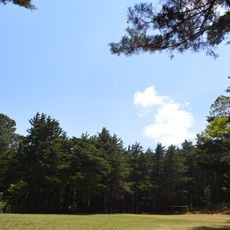
Montecristo National Park
19.2 km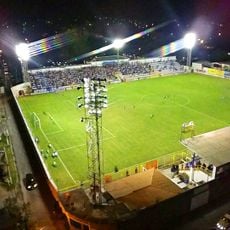
Estadio Jorge Calero Suárez
10.4 km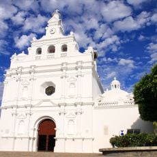
Iglesia de San Pedro Apóstol
10.5 km
Guajoyo hydroelectric power station
1.9 km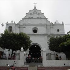
Iglesia del Calvario
10.9 km
Puente El Socorro
10.1 km
Antigua Capilla El Socorro
10 km
Apuzunga
3.5 km
Playa El Tablón
956 m
Lago de Guija
7.7 km
Caserio las conchas
7.8 km
Petroglyphs
680 m
Las Figuras
704 m
El Barcaje
25.5 km
Parque Corazones de Vida
4.4 km
Balneario Don Elias
3.4 km
Foto Arte Estudio
10.5 km
Foto Estudio Montecristo
10.4 km
Montecristo trifinio national park
15.7 km
Playa de Azacualpa
2.9 km
Playa El Amatal
4.7 km
Muurschildering, kunstwerk
12 km
Kunstwerk, standbeeld
10.4 km
Uitzichtpunt
25.2 km
Uitzichtpunt
26 km
Uitzichtpunt
15.4 km
Uitzichtpunt
20.6 km
Cascada Arcoiris
17.3 kmBeoordelingen
Heeft u deze plek bezocht? Tik op de sterren om een beoordeling te geven en uw ervaring of foto's te delen met de community! Probeer het nu! U kunt het op elk moment annuleren.
Ontdek verborgen schatten op elk avontuur!
Van karakteristieke kleine cafeetjes tot geheime uitzichtpunten – ontvlucht de drukte en vind plekken die echt bij jou passen. Onze app maakt het makkelijk: spraakzoekopdrachten, slimme filters, geoptimaliseerde routes en authentieke tips van reizigers wereldwijd. Download nu en beleef het avontuur op je smartphone!

Een nieuwe benadering van toeristische ontdekking❞
— Le Figaro
Alle plekken die de moeite waard zijn om te ontdekken❞
— France Info
Een uitstapje op maat in slechts een paar klikken❞
— 20 Minutes