Marine sanctuary
Locatie: Eastern Samar
GPS-coördinaten: 10.93861,125.76927
Laatste update: 14 november 2025 om 22:05
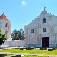
Guiuan Church
11.5 km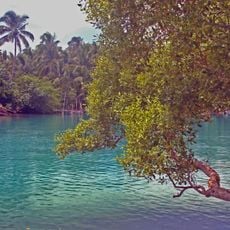
Guiuan Protected Landscape and Seascape
7.9 km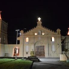
Balangiga Church
46.1 km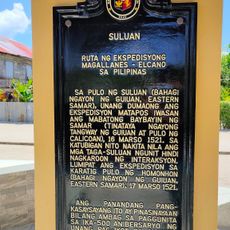
Suluan quincentennial historical marker
27.9 km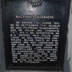
Balangiga Massacre historical marker
46 km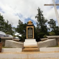
Homonhon quincentennial historical marker
27.3 km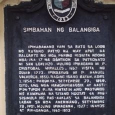
Church of Balangiga historical marker
46 km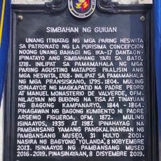
Church of Guiuan historical marker
11.5 km
United Nations Evacuation Center historical marker
14.2 km
Samar quincentennial historical marker
6.4 km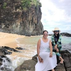
Handig Beach
15.1 km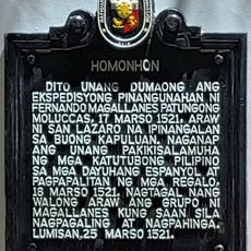
Homonhon historical marker
27.4 km
Linao Cave
6.5 km
Buro-Buro
10.2 km
Canhugas Nature Park
46.1 km
Marine Sanctuary
3.8 km
Guiuan Cultural Stage
11.3 km
Dumpao Beach
12.1 km
Sapao Beach
11.3 km
Calicoan View
7.1 km
Panglaw-beach
47 km
Dako Bato Beach
46.8 km
Panay Beach and Hernani Natural Pools
43.8 km
Magellan First Landing
27.5 km
Gedenkmonument
6.2 km
Jose Rizal Monument
11.4 km
Three Bells of Balangiga
46 km
Valeriano Abanador Statue
46 kmHeeft u deze plek bezocht? Tik op de sterren om een beoordeling te geven en uw ervaring of foto's te delen met de community! Probeer het nu! U kunt het op elk moment annuleren.
Ontdek verborgen schatten op elk avontuur!
Van karakteristieke kleine cafeetjes tot geheime uitzichtpunten – ontvlucht de drukte en vind plekken die echt bij jou passen. Onze app maakt het makkelijk: spraakzoekopdrachten, slimme filters, geoptimaliseerde routes en authentieke tips van reizigers wereldwijd. Download nu en beleef het avontuur op je smartphone!

Een nieuwe benadering van toeristische ontdekking❞
— Le Figaro
Alle plekken die de moeite waard zijn om te ontdekken❞
— France Info
Een uitstapje op maat in slechts een paar klikken❞
— 20 Minutes