Granary At Manor Farm, granary in Cherhill, Wiltshire, UK
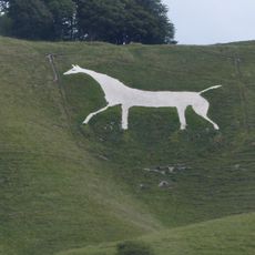
Cherhill White Horse
2.5 km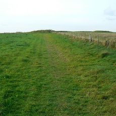
Windmill Hill
2.6 km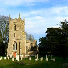
Church of All Saints
132 m
Pair of round barrows 200m SSE of Windmill Hill: part of the Windmill Hill round barrow cemetery.
2.6 km
Bowl barrow 200m south of Windmill Hill: part of the Windmill Hill round barrow cemetery.
2.4 km
A causewayed enclosure, the core of a round barrow cemetery, part of a prehistoric field system and an associated mortuary enclo
2.3 km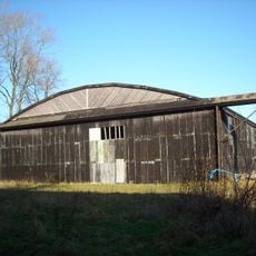
Two Former Hangars On North Side Of Former Airfield
1.1 km
Horslip long barrow, 450m north-west of Horslip Bridge.
2.5 km
Cross dyke 520m north east of Cherhill Monument
2.3 km
Pair of round barrows and section of linear earthwork NE of the gallops on West Down
2.5 km
Upper Farmhouse
2.6 km
The Manor House
64 m
Tudor Thatch
218 m
Nolands Farmhouse
865 m
Bowl barrow 200m east of Windmill Hill: part of the Windmill Hill round barrow cemetery.
2.7 km
Pair of bowl barrows on West Down, 550m east of Witch Plantation
2.6 km
Bowl barrow 350m north-east of White Horse Plantation
2 km
Bowl barrow 190m north east of Nolands Farm, Yatesbury
697 m
Former Hangar At North East Corner Of Former Airfield
711 m
Combined Officers Mess And Offices, Yatesbury Airfield
1.3 km
Two bowl barrows 320m south-east of Little London
912 m
Round barrow in Mount Wood, 300m north-east of Upper Lodge
2.7 km
Linear boundary earthwork and associated field system on Cherhill Down
2.1 km
Bowl barrow 400m west of Cooks Plantation
2 km
The Old Rectory
571 m
Three Monuments In Churchyard South Of Chancel Of Church Of All Saints
136 m
Manor House
144 m
Yatesbury House Farmhouse
494 mHeeft u deze plek bezocht? Tik op de sterren om een beoordeling te geven en uw ervaring of foto's te delen met de community! Probeer het nu! U kunt het op elk moment annuleren.
Ontdek verborgen schatten op elk avontuur!
Van karakteristieke kleine cafeetjes tot geheime uitzichtpunten – ontvlucht de drukte en vind plekken die echt bij jou passen. Onze app maakt het makkelijk: spraakzoekopdrachten, slimme filters, geoptimaliseerde routes en authentieke tips van reizigers wereldwijd. Download nu en beleef het avontuur op je smartphone!

Een nieuwe benadering van toeristische ontdekking❞
— Le Figaro
Alle plekken die de moeite waard zijn om te ontdekken❞
— France Info
Een uitstapje op maat in slechts een paar klikken❞
— 20 Minutes