Waterfall Cottage, cottage in Storrington and Sullington, Verenigd Koninkrijk
Locatie: Storrington and Sullington
GPS-coördinaten: 50.90662,-0.44858
Laatste update: 20 november 2025 om 04:31
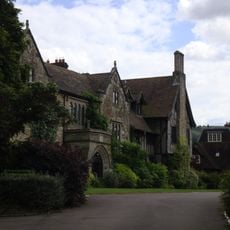
The Abbey, Storrington
1.1 km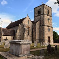
The Parish Church of St Mary the Virgin
1.2 km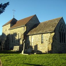
The Parish Church of St Mary
660 m
31 and 33, Church Street
1.2 km
Brook Cottage
1.2 km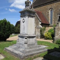
Storrington War Memorial
1.2 km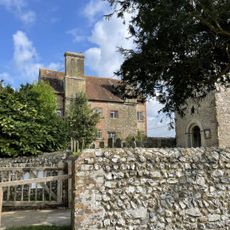
Sullington Manor
646 m
Byne
1.2 km
The Old House Cottage
1.1 km
Barn At Sullington Farm To The North East Of Sullington Manor House
697 m
Group of four bowl barrows at the Chantry Post
1.2 km
Cross dyke on Chantry Hill, 470m south of Grey Friars Farm
850 m
Brook House
1.2 km
Jasmine Cottage School Cottage
1.2 km
St Josephs Hall
1.1 km
Gateway At The North West Corner Of The Kitchen Garden Wall Of St Joseph's Dominican Convent At The Corner Of Brown's Lane And Church Street
1.2 km
Georgian House Including Front Garden Railing To East
1.2 km
Chantry Mill
774 m
The Old Rectory
847 m
The Horsecroft
1.1 km
Emmas Market And Old Rosemary
1.2 km
Pair Of Cottages And Attached Wall At St Joseph's Hall
1.1 km
Abbey Convent
1.1 km
Cross dyke on Sullington Hill, 500m south east of The Chantry
745 m
The Storrington And District Museum
1.2 km
2 And 4, East Brook
1.2 km
Orchard Dale
1.2 km
Nifty Art Gallery
1.2 kmBeoordelingen
Heeft u deze plek bezocht? Tik op de sterren om een beoordeling te geven en uw ervaring of foto's te delen met de community! Probeer het nu! U kunt het op elk moment annuleren.
Ontdek verborgen schatten op elk avontuur!
Van karakteristieke kleine cafeetjes tot geheime uitzichtpunten – ontvlucht de drukte en vind plekken die echt bij jou passen. Onze app maakt het makkelijk: spraakzoekopdrachten, slimme filters, geoptimaliseerde routes en authentieke tips van reizigers wereldwijd. Download nu en beleef het avontuur op je smartphone!

Een nieuwe benadering van toeristische ontdekking❞
— Le Figaro
Alle plekken die de moeite waard zijn om te ontdekken❞
— France Info
Een uitstapje op maat in slechts een paar klikken❞
— 20 Minutes