
Sighting Tower, tower in Bramhope, Leeds, West Yorkshire, UK

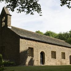
Puritan Chapel
1.1 km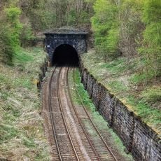
Portal To South Entrance Of Bramhope Railway Tunnel At Se 241 407
1.8 km
Methodist Church
824 m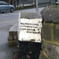
Milepost On East Corner Of Junction With Church Hill At Se 249 434
958 m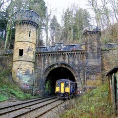
North Portal of Bramhope Tunnel
1.5 km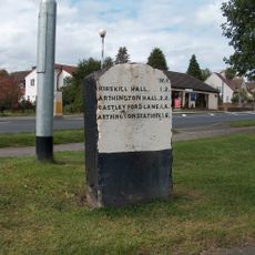
Milepost On West Corner Of Junction With Creskeld Lane At Se 258 428
1.2 km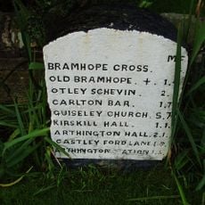
Milepost On East Corner Of Junction With Breary Lane East, At Se 256 430
1 km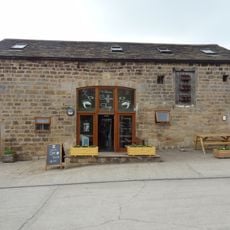
Barn To South West Of Crag House
1.3 km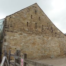
Aisled Barn To West Of Crag House
1.2 km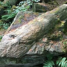
Fossilised tree trunk (Lepidodendron)
1.9 km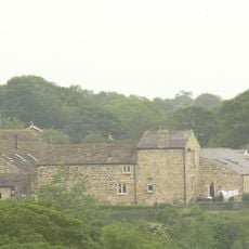
Cart Sheds And Outbuildings On South And East Sides Of Yard, East Of Moseley Farmhouse
1.9 km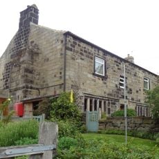
Crag House
1.2 km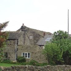
Lane End Farmhouse
1.3 km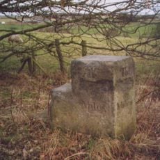
Milepost At Se 236 422
1.2 km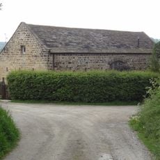
Barn On North Side Of Yard, East Of Moseley Farmhouse
1.9 km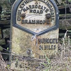
Milepost At Se 240 439
1.6 km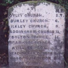
Milepost On South West Corner Of Junction With Pool Bank New Road, St Se 241440
1.6 km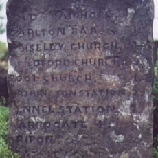
Milestone, Harrogate Road, just SW of jct with A660 at SE24114399
1.6 km
Milepost At Se 264 421
1.7 km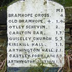
Milepost On East Corner Of Junction With Breary Lane At Se 255 430
1 km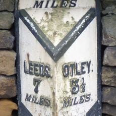
Milepost At Se 253 432
944 m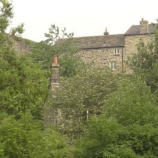
Stable, Granary Range, Cottage And Attached Archway East Of Moseley Farmhouse
1.9 km
Milepost On South East Corner Of Junction With Pool Bank New Road At Se 241 440
1.6 km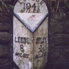
Milepost At Se 240 441
1.7 km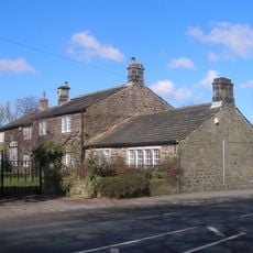
Smithy Hall
1.7 km
Retaining Walls Or Railway Cutting Extending Southwards From South Portal Of Bramhope Tunnel, At Se 241 407
1.9 km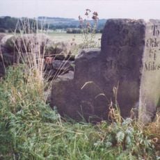
Milestone, Cookridge Lane, where it becomes Moor Road
904 m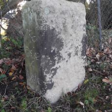
Milestone, just E of Leeds Road, jct Breary Lane East and Creskeld Lane
1.2 kmBeoordelingen
Heeft u deze plek bezocht? Tik op de sterren om een beoordeling te geven en uw ervaring of foto's te delen met de community! Probeer het nu! U kunt het op elk moment annuleren.
Ontdek verborgen schatten op elk avontuur!
Van karakteristieke kleine cafeetjes tot geheime uitzichtpunten – ontvlucht de drukte en vind plekken die echt bij jou passen. Onze app maakt het makkelijk: spraakzoekopdrachten, slimme filters, geoptimaliseerde routes en authentieke tips van reizigers wereldwijd. Download nu en beleef het avontuur op je smartphone!

Een nieuwe benadering van toeristische ontdekking❞
— Le Figaro
Alle plekken die de moeite waard zijn om te ontdekken❞
— France Info
Een uitstapje op maat in slechts een paar klikken❞
— 20 Minutes