Woolley

Inloggen op je account

AroundUs is een door de gemeenschap aangestuurde kaart van interessante plekken, gebouwd door nieuwsgierige ontdekkingsreizigers zoals jij. Het groeit met elke recensie, verhaal en foto die je deelt.
Log in om je favoriete plekken op te slaan, locaties toe te voegen en persoonlijke routes te maken.
Door door te gaan, accepteer je onze Algemene voorwaarden en ons Privacybeleid
Toevoegen aan collectie
Kaart
Wijziging voorstellen
Delen

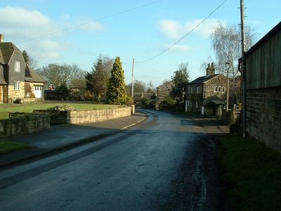
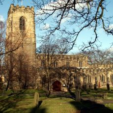
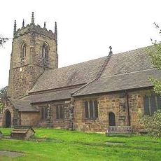
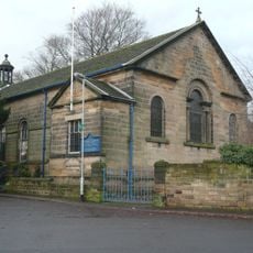
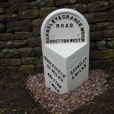
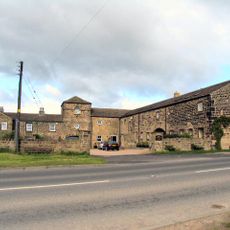
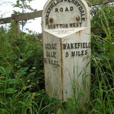
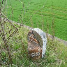
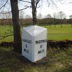
Woolley, village and civil parish in West Yorkshire, United Kingdom

Locatie: Wakefield

GPS-coördinaten: 53.61054,-1.52410

Laatste update: 3 maart 2025 om 00:52

Foto's
Rond deze plek
Toon de volledige kaart
Yorkshire Sculpture Park
Verenigd Koninkrijk

Yorkshire Sculpture Park

3 km
Bretton Hall College
Verenigd Koninkrijk

Bretton Hall College

3.2 km
Bretton Hall
Verenigd Koninkrijk

Bretton Hall

3.2 km
Woolley Hall
Verenigd Koninkrijk

Woolley Hall

1.2 km
Church In Bretton Park
Verenigd Koninkrijk

Church In Bretton Park

2.6 km
Church of All Saints
Verenigd Koninkrijk

Church of All Saints

2.9 km
Church of St Peter, Woolley
Verenigd Koninkrijk

Church of St Peter, Woolley

427 m
Rock Well approximately 50 metres west of Dam Head Cottages in Bretton Park
Verenigd Koninkrijk

Rock Well approximately 50 metres west of Dam Head Cottages in Bretton Park

2.6 km
Church of St James
Verenigd Koninkrijk

Church of St James

3.1 km
Milepost Approximately 600 Metres South Of Junction With Park Road
Verenigd Koninkrijk

Milepost Approximately 600 Metres South Of Junction With Park Road

2.5 km
Archway Lodge In Bretton Park Including Flanking Walls
Verenigd Koninkrijk

Archway Lodge In Bretton Park Including Flanking Walls

2.7 km
Bridge Over The Cut
Verenigd Koninkrijk

Bridge Over The Cut

2.6 km
Birthwaite Hall Including Attached Range To West
Verenigd Koninkrijk

Birthwaite Hall Including Attached Range To West

2.7 km
Cascade Bridge And Weir In Bretton Park
Verenigd Koninkrijk

Cascade Bridge And Weir In Bretton Park

3.5 km
Barugh Bridge
Verenigd Koninkrijk

Barugh Bridge

3.7 km
Bridge Over The Cut Immediately North Of Cascade Bridge In Bretton Park
Verenigd Koninkrijk

Bridge Over The Cut Immediately North Of Cascade Bridge In Bretton Park

3.5 km
Wheelhouse Restaurant
Verenigd Koninkrijk

Wheelhouse Restaurant

3.5 km
Summer house in Bridge Royd Wood approximately 200 metres west of Cascade Bridge in Breton Park
Verenigd Koninkrijk

Summer house in Bridge Royd Wood approximately 200 metres west of Cascade Bridge in Breton Park

3.6 km
Windhill Gate Farmhouse An Attached Outbuildings
Verenigd Koninkrijk

Windhill Gate Farmhouse An Attached Outbuildings

1.3 km
Milepost Approximately 1000 Metres North East Of West Bretton Traffic Island
Verenigd Koninkrijk

Milepost Approximately 1000 Metres North East Of West Bretton Traffic Island

3.5 km
Milestone Approximately 100 Metres South Of Track To Snapethorpe Farm
Verenigd Koninkrijk

Milestone Approximately 100 Metres South Of Track To Snapethorpe Farm

3 km
Milestone Approximately 200 Metres North Of Junction With Spring Lane
Verenigd Koninkrijk

Milestone Approximately 200 Metres North Of Junction With Spring Lane

2.3 km
Camellia House in Bretton Park approximately 80 metres west of Bretton Hall
Verenigd Koninkrijk

Camellia House in Bretton Park approximately 80 metres west of Bretton Hall

3.3 km
Footbridge in Menagerie Wood approximately 200 metres south east of Cascade Bridge in Bretton Park
Verenigd Koninkrijk

Footbridge in Menagerie Wood approximately 200 metres south east of Cascade Bridge in Bretton Park

3.3 km
Overflow to Lower Lake, 3 weirs to east side of dam and pump house adjacent to Middle Weir in Bretton Park
Verenigd Koninkrijk

Overflow to Lower Lake, 3 weirs to east side of dam and pump house adjacent to Middle Weir in Bretton Park

2.6 km
Milestone Approximately 10 Metres North Of Junction With Branch Road
Verenigd Koninkrijk

Milestone Approximately 10 Metres North Of Junction With Branch Road

3.5 km
The Boat House
Verenigd Koninkrijk

The Boat House

3.4 km
Milestone, 175m N of Woolley X-roads, adj SLOW on road
Verenigd Koninkrijk

Milestone, 175m N of Woolley X-roads, adj SLOW on road

1.9 km
Toon de volledige kaart
Beoordelingen

Heeft u deze plek bezocht? Tik op de sterren om een beoordeling te geven en uw ervaring of foto's te delen met de community! Probeer het nu! U kunt het op elk moment annuleren.

« Woolley - village and civil parish in West Yorkshire, United Kingdom » wordt geleverd door Around Us (nl.aroundus.com). Afbeeldingen en teksten zijn afkomstig van het Wikimedia-project onder een Creative Commons-licentie. U mag kopieën van deze pagina kopiëren, verspreiden en wijzigen onder de voorwaarden van de licentie, zolang deze opmerking duidelijk zichtbaar is.

Ontdek verborgen schatten op elk avontuur!

Van karakteristieke kleine cafeetjes tot geheime uitzichtpunten – ontvlucht de drukte en vind plekken die echt bij jou passen. Onze app maakt het makkelijk: spraakzoekopdrachten, slimme filters, geoptimaliseerde routes en authentieke tips van reizigers wereldwijd. Download nu en beleef het avontuur op je smartphone!

Around Us App Screenshot

Een nieuwe benadering van toeristische ontdekking

Le Figaro

Alle plekken die de moeite waard zijn om te ontdekken

France Info

Een uitstapje op maat in slechts een paar klikken

20 Minutes