
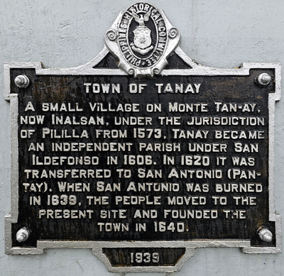
Town of Tanay historical marker
Town of Tanay historical marker, PHC historical marker for Tanay, Rizal
Locatie: Tanay
Ontstaan: 1939
Maker: National Historical Commission of the Philippines
Adres: M.H. del Pilar Street, Plaza Aldea
GPS-coördinaten: 14.49806,121.28493
Laatste update: 15 maart 2025 om 12:35
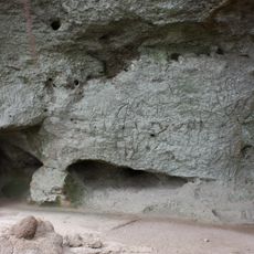
Angono Petroglyphs
11.3 km
Antipolo Cathedral
15.3 km
Masungi Georeserve
13.2 km
Manggahan Floodway
16.3 km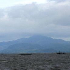
Mount Sembrano
15.3 km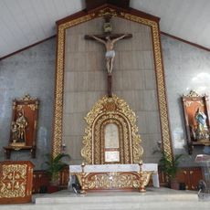
Santuario de San Jose
15.6 km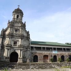
Morong Church
3.4 km
Bosay Resort
15.4 km
Morong High School
5.9 km
Antipolo Star Resort
12.2 km
Blanco Family Museum
14.9 km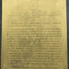
Juan M. Sumulong historical marker
15.4 km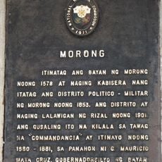
Morong historical marker
5.2 km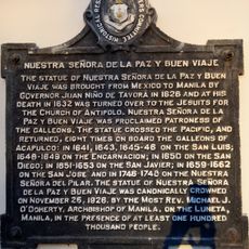
Our Lady of Peace and Good Voyage historical marker
15.4 km
Casa Santa Museum
15.6 km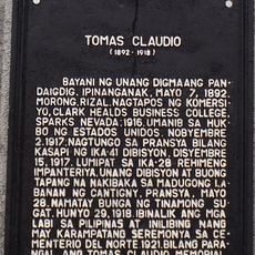
Tomas Claudio historical marker
5.3 km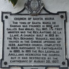
Church of Santa Maria historical marker
15.2 km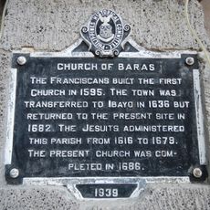
Church of Baras historical marker
3.3 km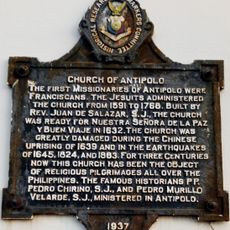
Church of Antipolo historical marker
15.4 km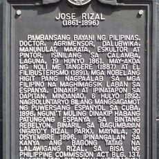
Jose Rizal historical marker
15.9 km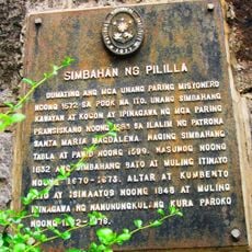
Pililla Church historical marker
3.1 km
East Ville Resort
12.6 km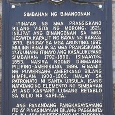
Church of Binangonan historical marker
10.6 km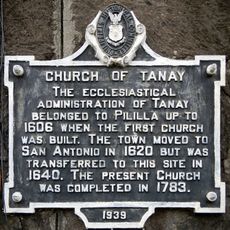
Church of Tanay historical marker
52 m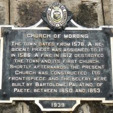
Church of Morong historical marker
5.4 km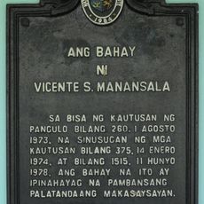
Vicente Manasala House historical marker
12.8 km
Rizal Provincial Capitol
15.9 km
Commandancia
5.2 kmHeeft u deze plek bezocht? Tik op de sterren om een beoordeling te geven en uw ervaring of foto's te delen met de community! Probeer het nu! U kunt het op elk moment annuleren.
Ontdek verborgen schatten op elk avontuur!
Van karakteristieke kleine cafeetjes tot geheime uitzichtpunten – ontvlucht de drukte en vind plekken die echt bij jou passen. Onze app maakt het makkelijk: spraakzoekopdrachten, slimme filters, geoptimaliseerde routes en authentieke tips van reizigers wereldwijd. Download nu en beleef het avontuur op je smartphone!

Een nieuwe benadering van toeristische ontdekking❞
— Le Figaro
Alle plekken die de moeite waard zijn om te ontdekken❞
— France Info
Een uitstapje op maat in slechts een paar klikken❞
— 20 Minutes