
Lubo Island Beach, Strand auf den Philippinen
Locatie: Davao del Sur
Hoogte boven de zeespiegel: 4 m
GPS-coördinaten: 6.83917,125.42083
Laatste update: 5 april 2025 om 20:15
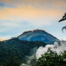
Mount Apo
23.4 km
Mount Matutum
65.6 km
Kathedraal van Davao
32.6 km
Monfort Bat Sanctuary
47 km
Epol Falls
71.3 km
Davao River Bridge
35.3 km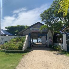
Isla Reta Beach Resort
34.8 km
Mount Apo Natural Park
20.9 km
Secdea Beach Resort Reception Area
50.5 km
D' Bone Collector Museum
32.5 km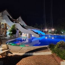
Sea Eagles Beach Resort
67.1 km
Museo Dabawenyo
30.7 km
Tagum Cathedral
79 km
Costa Marina Beach Resort
39.4 km
Burial Site of the Seventeen Filipino Martyrs of Koronadal historical marker
74.5 km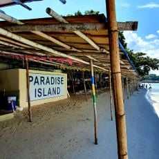
Blue Jaz Beach Resort & Water Park
40 km
Davao City Hall historical marker
32.5 km
Tagum Historical & Cultural Center
79.9 km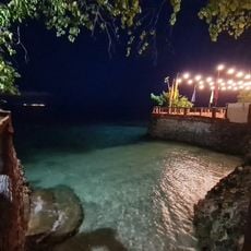
Ilihan Beach Resort
50.8 km
Andres Bonifacio historical marker
21.7 km
Pasol Mo
32.7 km
Davao Museum of History and Ethnography
38.8 km
Ohta Kyozaburo historical marker
29.7 km
Museyo Kutawato
55.6 km
KCC Cinema
73.4 km
Koronadal Cathedral
74.4 km
Port Sta. Ana historical marker
34.7 km
Datu Paglas Municipal Hall
61.7 kmHeeft u deze plek bezocht? Tik op de sterren om een beoordeling te geven en uw ervaring of foto's te delen met de community! Probeer het nu! U kunt het op elk moment annuleren.
Ontdek verborgen schatten op elk avontuur!
Van karakteristieke kleine cafeetjes tot geheime uitzichtpunten – ontvlucht de drukte en vind plekken die echt bij jou passen. Onze app maakt het makkelijk: spraakzoekopdrachten, slimme filters, geoptimaliseerde routes en authentieke tips van reizigers wereldwijd. Download nu en beleef het avontuur op je smartphone!

Een nieuwe benadering van toeristische ontdekking❞
— Le Figaro
Alle plekken die de moeite waard zijn om te ontdekken❞
— France Info
Een uitstapje op maat in slechts een paar klikken❞
— 20 Minutes