
San Vicente, gemeente in de Filipijnse provincie Northern Samar
Locatie: Northern Samar
Hoogte boven de zeespiegel: 3 m
Grenst aan: Batuan
GPS-coördinaten: 12.35000,124.05000
Laatste update: 15 mei 2025 om 22:39
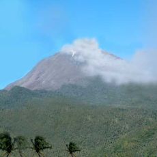
Mount Bulusan
46.7 km
Calbayog Cathedral
67.2 km
Capul Church
16.5 km
Bulusan Volcano National Park
46.8 km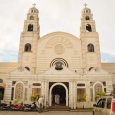
Sorsogon Cathedral
69 km
Capul Island Lighthouse
17.7 km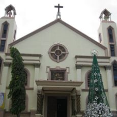
Masbate Cathedral
46.9 km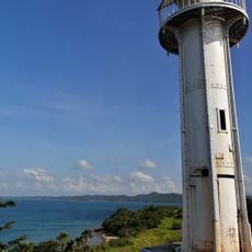
Bagatao Island Lighthouse
60.6 km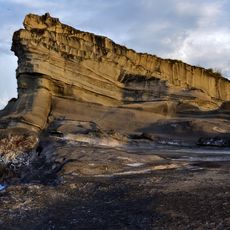
Biri Larosa Protected Landscape and Seascape
48.9 km
Our Lady of the Annunciation Cathedral Parish
65.9 km
Magasang Rock Formation
51.8 km
The Forts of Bulusan historical marker
45.7 km
Agta Beach
86.2 km
Church of Capul historical marker
16.5 km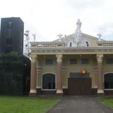
Bacon Church
76.5 km
Bituon Beach Resort
37.5 km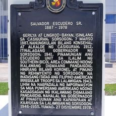
Salvador Escudero Sr. historical marker
69.3 km
University of Eastern Philippines historical marker
69.4 km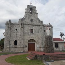
Barcelona Church
58.5 km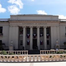
Sorsogon Provincial Capitol
69.4 km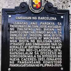
Church of Barcelona historical marker
58.5 km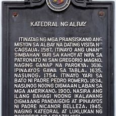
Cathedral of Albay historical marker
94.3 km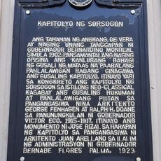
Capitol of Sorsogon historical marker
69.4 km
Capul Lighthouse historical marker
17.7 km
Cathedral of Calbayog historical marker
67.2 km
Magsapad Rock Formation
51.9 km
Caranas Rock Formation
52.1 km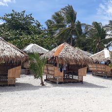
Limpiado Beach
90.8 kmBeoordelingen
Heeft u deze plek bezocht? Tik op de sterren om een beoordeling te geven en uw ervaring of foto's te delen met de community! Probeer het nu! U kunt het op elk moment annuleren.
Ontdek verborgen schatten op elk avontuur!
Van karakteristieke kleine cafeetjes tot geheime uitzichtpunten – ontvlucht de drukte en vind plekken die echt bij jou passen. Onze app maakt het makkelijk: spraakzoekopdrachten, slimme filters, geoptimaliseerde routes en authentieke tips van reizigers wereldwijd. Download nu en beleef het avontuur op je smartphone!

Een nieuwe benadering van toeristische ontdekking❞
— Le Figaro
Alle plekken die de moeite waard zijn om te ontdekken❞
— France Info
Een uitstapje op maat in slechts een paar klikken❞
— 20 Minutes