Frías District, district in Piura, Peru
Locatie: Ayabaca Province
Hoofdstad: Frías
Hoogte boven de zeespiegel: 1.650 m
Grenst aan: Lagunas District, Pacaipampa District, Sapillica District, Chalaco District, Chulucanas District, Santo Domingo District, Tambogrande District
GPS-coördinaten: -4.93156,-79.94725
Laatste update: 2 maart 2025 om 23:09

Tumbes Mangals National Sanctuary
172.2 km
Podocarpus National Park
127.5 km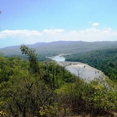
Nationaal park Cerros de Amotape
112.7 km
Batán Grande
172.1 km
Laquipampa Wildlife Refuge
166.1 km
Arenillas Ecological Reserve
156.6 km
Yacurí National Park
69.3 km
Basilica of El Cisne
133.5 km
Bernal Municipal Stadium
105.1 km
Narihualá
91.4 km
Poechos Reservoir
68.3 km
Estadio Miguel Grau
79.7 km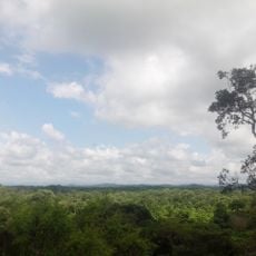
Tumbes National Reserve
121.7 km
Illescas Reserved Zone
172.4 km
Pongo de Rentema
167.8 km
Cathedral of Loja-Parroquia El Sagrario
133 km
Casa Museo Gran Almirante Grau
81 km
Puente Bolognesi
80.9 km
Iglesia San Martín de Tours de Sechura
119.5 km
Iglesia San Juan Bautista, Catacaos
90.1 km
Church of Our Lady of the Pillar
41.4 km
Jardín botánico Reinaldo Espinosa
101.4 km
Cerro de Arcos
162 km
St. Nicholas Cathedral, Tumbes
161.9 km
La Leche River
167.5 km
Ñaupe River
95.9 km
Macará River
75.1 km
Tren Crucero
135 kmHeeft u deze plek bezocht? Tik op de sterren om een beoordeling te geven en uw ervaring of foto's te delen met de community! Probeer het nu! U kunt het op elk moment annuleren.
Ontdek verborgen schatten op elk avontuur!
Van karakteristieke kleine cafeetjes tot geheime uitzichtpunten – ontvlucht de drukte en vind plekken die echt bij jou passen. Onze app maakt het makkelijk: spraakzoekopdrachten, slimme filters, geoptimaliseerde routes en authentieke tips van reizigers wereldwijd. Download nu en beleef het avontuur op je smartphone!

Een nieuwe benadering van toeristische ontdekking❞
— Le Figaro
Alle plekken die de moeite waard zijn om te ontdekken❞
— France Info
Een uitstapje op maat in slechts een paar klikken❞
— 20 Minutes