
Chimney Rock Farm, historic building near Tazewell, Tazewell County, Virginia
Locatie: Tazewell County
GPS-coördinaten: 37.07750,-81.60917
Laatste update: 23 september 2025 om 15:47
Hungry Mother State Park
22.8 km
Lincoln Theatre
28.3 km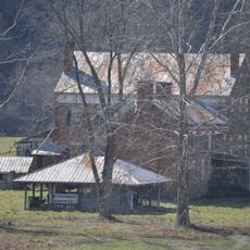
Preston House
30.3 km
U.S. Coal and Coke Company Store
31 km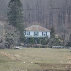
Mountain Glen
26.1 km
Beartown Wilderness
14.9 km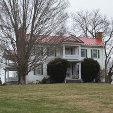
Maiden Spring
8.2 km
Pocahontas Fuel Company Store and Office Buildings
28.9 km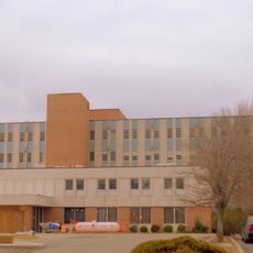
Smyth County Community Hospital
26.5 km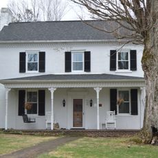
James Wynn House
9 km
Preston House
26.7 km
Saltville Battlefields Historic District
26.4 km
Henderson Building
28.5 km
Big Crab Orchard Site
5.6 km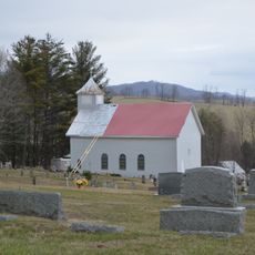
Sharon Lutheran Church and Cemetery
24 km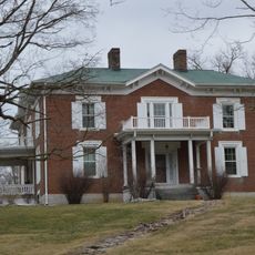
Alexander St. Clair House
31.3 km
Marion Historic District (Marion, Virginia)
28.4 km
George Oscar Thompson House
4.8 km
Tazewell Historic District
9 km
Capt. James Moore Homestead
28.6 km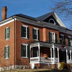
Marion Male Academy
28.4 km
Richlands Historic District
17.6 km
Williams House
16.9 km
Clinch Valley Roller Mills
14 km
Saltville Historic District
26.4 km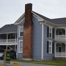
Old Kentucky Turnpike Historic District
13.8 km
Scott-Walker House
23.8 km
Clynchdale
11.9 kmHeeft u deze plek bezocht? Tik op de sterren om een beoordeling te geven en uw ervaring of foto's te delen met de community! Probeer het nu! U kunt het op elk moment annuleren.
Ontdek verborgen schatten op elk avontuur!
Van karakteristieke kleine cafeetjes tot geheime uitzichtpunten – ontvlucht de drukte en vind plekken die echt bij jou passen. Onze app maakt het makkelijk: spraakzoekopdrachten, slimme filters, geoptimaliseerde routes en authentieke tips van reizigers wereldwijd. Download nu en beleef het avontuur op je smartphone!

Een nieuwe benadering van toeristische ontdekking❞
— Le Figaro
Alle plekken die de moeite waard zijn om te ontdekken❞
— France Info
Een uitstapje op maat in slechts een paar klikken❞
— 20 Minutes