
Isabang, barangay in Lucena, Filipijnen
Locatie: Lucena
Hoogte boven de zeespiegel: 98 m
GPS-coördinaten: 13.94860,121.58390
Laatste update: 12 oktober 2025 om 11:46

Mount Banahaw
16.5 km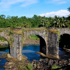
Malagonlong Bridge
8 km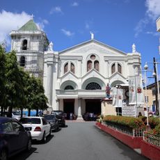
Lucena Cathedral
3.4 km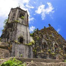
Lucban Church
18.8 km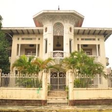
Gala–Rodriguez House
6.5 km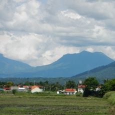
Mounts Banahaw–San Cristobal Protected Landscape
15.8 km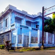
Don Catalino Rodriguez Ancestral House
6.5 km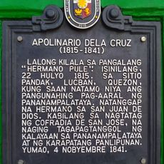
Apolinario dela Cruz historical marker
2.5 km
Parco nazionale di Mounts-Banahaw-San-Cristobal
17.1 km
Nawawalang Paraiso
11.1 km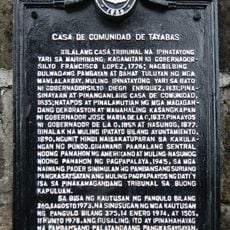
Casa de Comunidad de Tayabas historical marker
8.6 km
Lucban Municipal Hall
18.7 km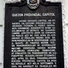
Quezon Provincial Capitol historical marker
3.9 km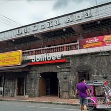
La Doña Ana
18.7 km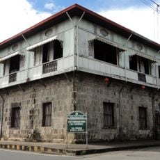
Casa Comunidad of Tayabas
8.6 km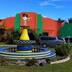
Pueblo por la Playa
12.3 km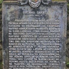
Macario Sakay historical marker
19.1 km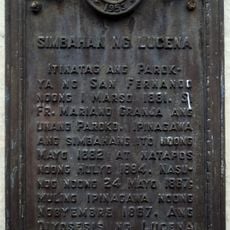
Church of Lucena historical marker
3.4 km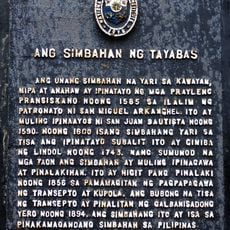
The Church of Tayabas historical marker
8.6 km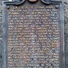
La Casa de Doña Ana historical marker
18.7 km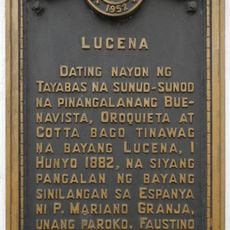
Lucena historical marker
3.5 km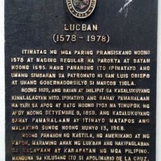
Lucban historical marker
18.7 km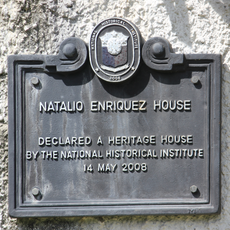
Natalio Enriquez House historical marker
6.6 km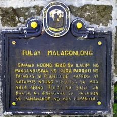
Malagonlong Bridge historical marker
8 km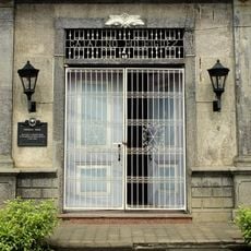
Rodriguez House historical marker
6.6 km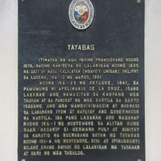
Tayabas historical marker
8.6 km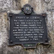
Church of Lucban historical marker
18.8 km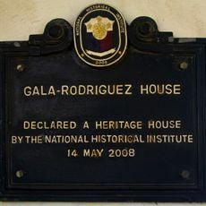
Gala-Rodriguez House historical marker
6.5 kmHeeft u deze plek bezocht? Tik op de sterren om een beoordeling te geven en uw ervaring of foto's te delen met de community! Probeer het nu! U kunt het op elk moment annuleren.
Ontdek verborgen schatten op elk avontuur!
Van karakteristieke kleine cafeetjes tot geheime uitzichtpunten – ontvlucht de drukte en vind plekken die echt bij jou passen. Onze app maakt het makkelijk: spraakzoekopdrachten, slimme filters, geoptimaliseerde routes en authentieke tips van reizigers wereldwijd. Download nu en beleef het avontuur op je smartphone!

Een nieuwe benadering van toeristische ontdekking❞
— Le Figaro
Alle plekken die de moeite waard zijn om te ontdekken❞
— France Info
Een uitstapje op maat in slechts een paar klikken❞
— 20 Minutes